| P number: | P000872 |
|---|---|
| Old photograph number: | D02499 |
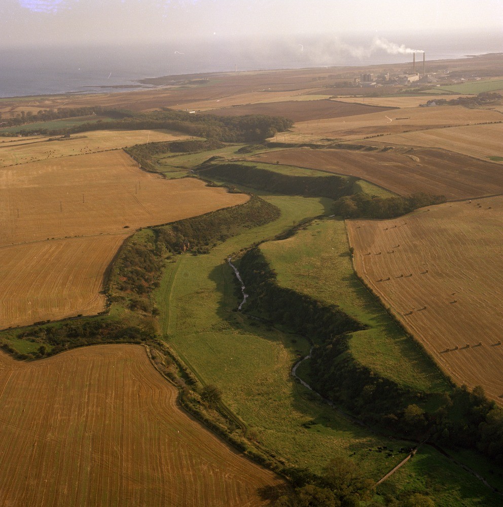
| Caption: | Oblique aerial view of Spott Burn, 2.5 km. south of Dunbar. Looking east. East Lothian. Spott Burn glacial meltwater channel. |
| Description: | Oblique aerial view of Spott Burn, 2.5 km. south of Dunbar. Looking east. East Lothian. Spott Burn glacial meltwater channel. The present river is obviously a misfit in a larger valley, cut when there was a tremendous amount of water available from the melting ice at the end of the last glaciation. Note the Oxwell Mains opencast limestone workings in the distance on the right. During deglaciation, as the climate improved and the ice-sheet covering the area began to break up the Southern Upland ice retreated south to form an isolated cap with glaciers in such valleys as the Whiteadder. Ice-free ground appeared along the slopes of the Lammermuir Hills. Large volumes of glacial meltwater were released to cut numerous glacial meltwater channels. |
| Date taken: | Sat Jan 01 00:00:00 GMT 1977 |
| Photographer: | Christie, A. |
| Copyright statement: | NERC |
| Acknowledgment: | This image was digitized with grant-in-aid from SCRAN the Scottish Cultural Resources Access Network |
| X longitude/easting: | 367800 |
| Y latitude/northing: | 676380 |
| Coordinate reference system, ESPG code: | 27700 (OSGB 1936 / British National Grid) |
| Orientation: | Portrait |
| Size: | 273.51 KB; 992 x 1000 pixels; 84 x 85 mm (print at 300 DPI); 262 x 265 mm (screen at 96 DPI); |
| Average Rating: | Not yet rated |
| Categories: | Unsorted Images |
Loading...
Loading...
Reviews
There is currently no feedback