| P number: | P000871 |
|---|---|
| Old photograph number: | D02498 |
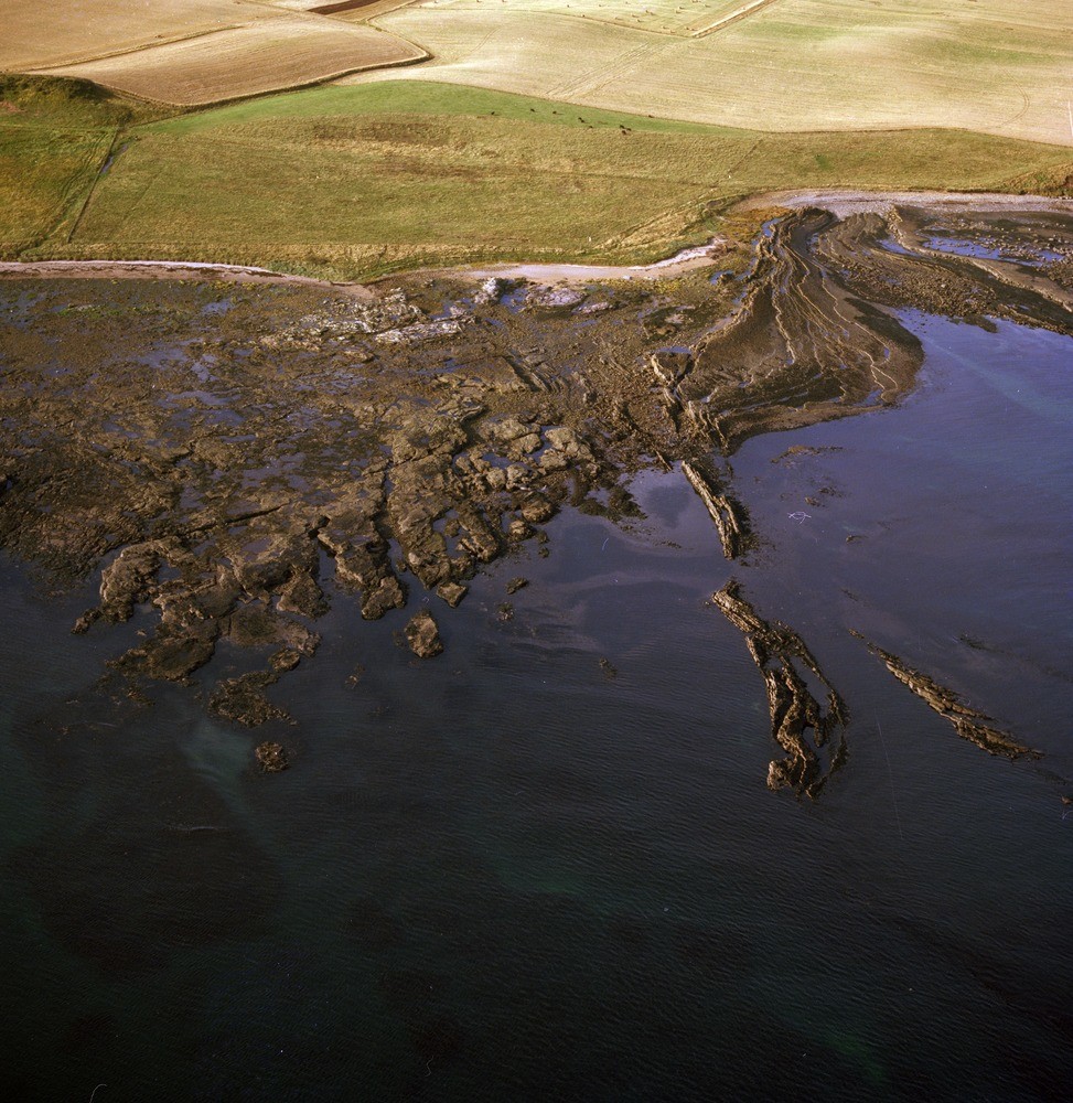
| Caption: | Oblique aerial view of the coast at Long Craig, 8 km. south-east of Dunbar and just south of Torness Point. East Lothian. The type locality of the Upper Longcraig Limestone, part of the Lower Limestone Group of the Carboniferous. |
| Description: | Oblique aerial view of the coast at Long Craig, 8 km. south-east of Dunbar and just south of Torness Point. East Lothian. The type locality of the Upper Longcraig Limestone, part of the Lower Limestone Group of the Carboniferous. View from sea (just south of east) of Upper Longcraig Limestone where a rugose coral band within this six metre thick limestone forms a sinuous reef abruptly cut off to south by faulting. During deglaciation as the climate improved, the ice retreated and melted leaving ice-free ground along the slopes of the Lammermuir Hills. Large volumes of glacial meltwater were released to cut numerous glacial meltwater channels. Ice lying in the low ground blocked the river valleys, so damming the meltwaters which were forced to cut new channels along the ice margin and across cols into other valleys. |
| Date taken: | Sat Jan 01 00:00:00 GMT 1977 |
| Photographer: | Christie, A. |
| Copyright statement: | NERC |
| Acknowledgment: | This image was digitized with grant-in-aid from SCRAN the Scottish Cultural Resources Access Network |
| X longitude/easting: | 375150 |
| Y latitude/northing: | 675150 |
| Coordinate reference system, ESPG code: | 27700 (OSGB 1936 / British National Grid) |
| Orientation: | Portrait |
| Size: | 309.05 KB; 973 x 1000 pixels; 82 x 85 mm (print at 300 DPI); 257 x 265 mm (screen at 96 DPI); |
| Average Rating: | Not yet rated |
| Categories: | Unsorted Images |
Loading...
Loading...
Reviews
There is currently no feedback