| P number: | P213133 |
|---|---|
| Old photograph number: | A14166 |
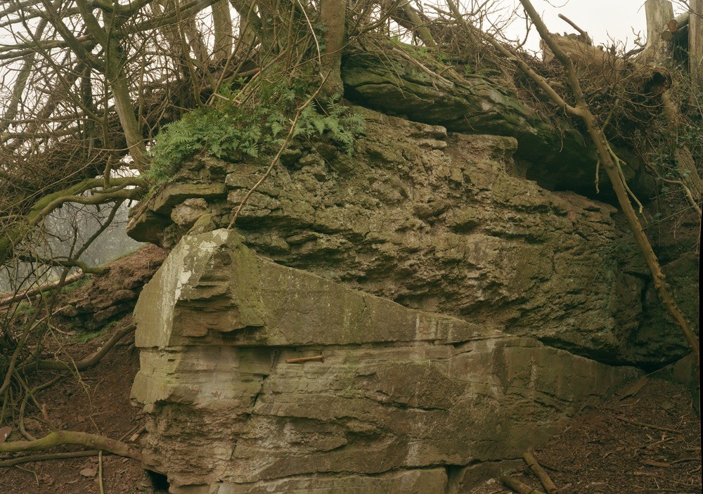
| Caption: | Quarry, 470 m. at 278 degrees from Barnstone Farm. |
| Description: | Quarry, 470 m. at 278 degrees from Barnstone Farm. Sandstone and intraformation conglomerate, St. Maughan's Formation. View shows prominent erosion plane at base of a cornstone conglomerate. The conglomerate is strongly erosional on thin-bedded, medium-grained, purple-red-brown sandstone with lenses of similar conglomerate. Hammer length is 30 cm. |
| Date taken: | Sun Jan 01 00:00:00 GMT 1984 |
| Photographer: | Jeffery, C.J. |
| Copyright statement: | NERC |
| X longitude/easting: | 357650 |
| Y latitude/northing: | 253390 |
| Coordinate reference system, ESPG code: | 27700 (OSGB 1936 / British National Grid) |
| Orientation: | Landscape |
| Size: | 299.52 KB; 1000 x 703 pixels; 85 x 60 mm (print at 300 DPI); 265 x 186 mm (screen at 96 DPI); |
| Average Rating: | Not yet rated |
| Categories: | Unsorted Images, Geoscience subjects/ Rocks, sedimentary/ Sandstone |
Loading...
Loading...
Reviews
There is currently no feedback