| P number: | P213067 |
|---|---|
| Old photograph number: | A14099 |
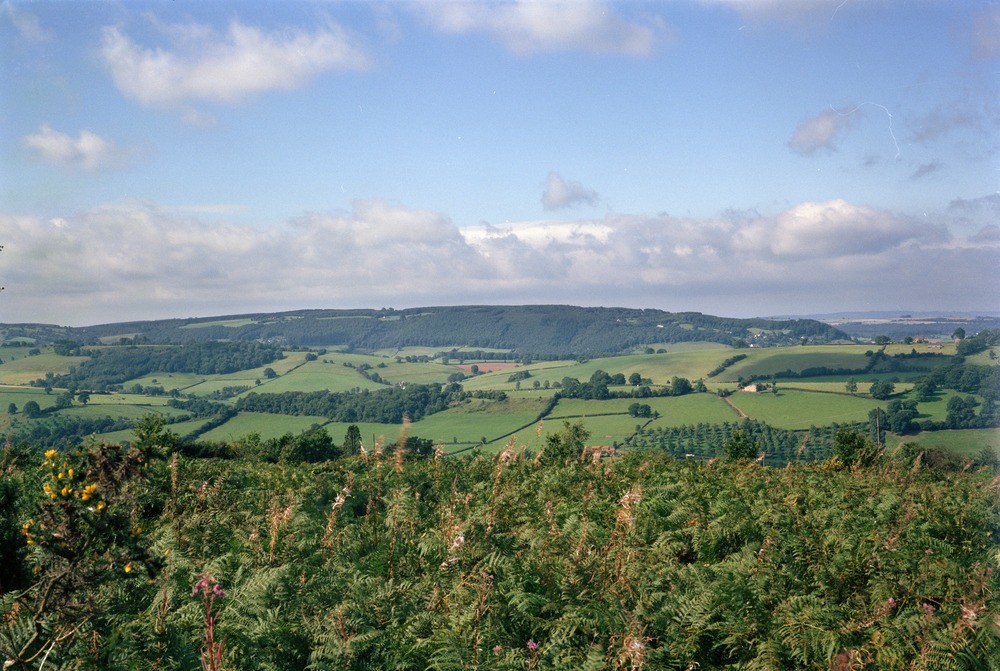
| Caption: | NW side of May Hill on Yartleton Lane. Looking SW. |
| Description: | NW side of May Hill on Yartleton Lane. Looking SW. General view south-west from May Hill. Three main features are visible in the centre of the photograph, beyond May Hill; the closest one, on which the farm house (middle right) is situated, is formed by the Psammosteus Limestone at the boundary between the Raglan Marl and St. Maughan's Group, the next is the Brownstones escarpment, and the farthest, wood ridge is capped by Drybrook Sandstone, in the Forest of Dean. |
| Date taken: | Fri Jan 01 00:00:00 GMT 1982 |
| Photographer: | Jeffery, C.J. |
| Copyright statement: | NERC |
| X longitude/easting: | 369000 |
| Y latitude/northing: | 222050 |
| Coordinate reference system, ESPG code: | 27700 (OSGB 1936 / British National Grid) |
| Orientation: | Landscape |
| Size: | 251.71 KB; 1000 x 671 pixels; 85 x 57 mm (print at 300 DPI); 265 x 178 mm (screen at 96 DPI); |
| Average Rating: | Not yet rated |
| Categories: | Unsorted Images |
Loading...
Loading...
Reviews
There is currently no feedback