| P number: | P213029 |
|---|---|
| Old photograph number: | A14052 |
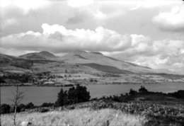
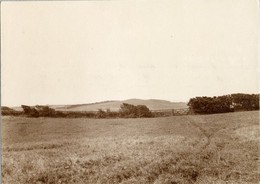
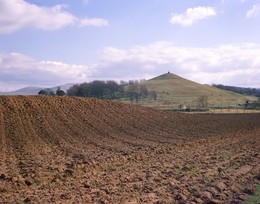
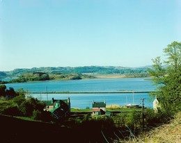
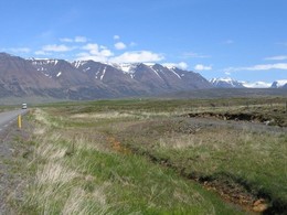
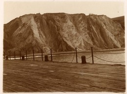
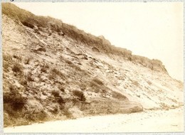
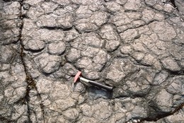
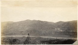
| Caption: | Black Mill Lane, approx 1 km. W. of Fontwell, near Chichester. |
| Description: | Black Mill Lane, approx 1 km. W. of Fontwell, near Chichester. Head Gravel of upper coastal plain. View north-west over ploughed field on surface of Head Gravel of upper coastal plain. South Downs on skyline are capped by Halnaker Windmill. The ploughed soil gives a good impression of the angular nature of the Head Gravel. A few pebbles derived from raised storm beach deposits to the south are present near this locality. |
| Date taken: | Thu Oct 01 00:00:00 BST 1981 |
| Photographer: | Collins, R.E. |
| Copyright statement: | NERC |
| X longitude/easting: | 493500 |
| Y latitude/northing: | 107300 |
| Coordinate reference system, ESPG code: | 27700 (OSGB 1936 / British National Grid) |
| Orientation: | Landscape |
| Size: | 288.86 KB; 1000 x 664 pixels; 85 x 56 mm (print at 300 DPI); 265 x 176 mm (screen at 96 DPI); |
| Average Rating: | Not yet rated |
| Categories: | Unsorted Images |
Loading...
Loading...
Reviews
There is currently no feedback