| P number: | P212935 |
|---|---|
| Old photograph number: | A13958 |
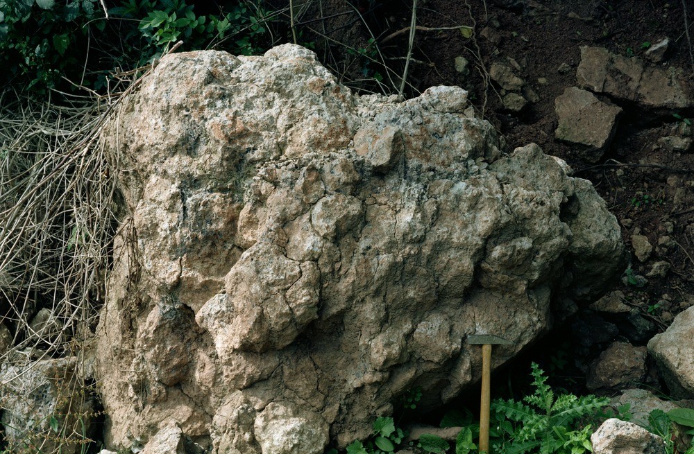
| Caption: | Forestry track, Nupton Hill. |
| Description: | Forestry track, Nupton Hill. Pedogenic limestone. Formerly known as the 'Psammosteus Limestone', this bed marks the boundary between the Raglan Mudstone and the St. Maughan's Formation. Here the bed is 1.8 m. in thickness, only the upper more massive part is shown. The lower part of the bed is more rubbly in appearance consisting of nodules of calcium carbonate in a mudstone or siltstone matrix. |
| Date taken: | Fri Jan 01 00:00:00 GMT 1982 |
| Photographer: | Jeffery, C.J. |
| Copyright statement: | NERC |
| X longitude/easting: | 344530 |
| Y latitude/northing: | 248140 |
| Coordinate reference system, ESPG code: | 27700 (OSGB 1936 / British National Grid) |
| Orientation: | Landscape |
| Size: | 310.92 KB; 1000 x 655 pixels; 85 x 55 mm (print at 300 DPI); 265 x 173 mm (screen at 96 DPI); |
| Average Rating: | Not yet rated |
| Categories: | Unsorted Images, Geoscience subjects/ Rocks, sedimentary/ Limestone |
Loading...
Loading...
Reviews
There is currently no feedback