| P number: | P212882 |
|---|---|
| Old photograph number: | A13905 |
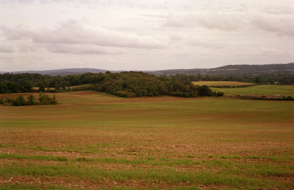
| Caption: | S. side of Guildford and Godalming Bypass, approx 1.2 km. N. 40 degrees E. of Compton. |
| Description: | S. side of Guildford and Godalming Bypass, approx 1.2 km. N. 40 degrees E. of Compton. Chalk, Gault and Lower Greensand scenery. This set of three photographs forms a panorama. In the foreground Chalk soils, showing up in the ploughed field, form part of the North Downs scarp face hereabouts. A fault cuts out part of the Middle and Lower Chalk in the middle distance. Beyond this occur the Upper Greensand and Gault which shows up clearly as a darker brown band of soil. The wooded hills beyond the Gault outcrop are on sandy Folkestone Beds of the Lower Greensand. The distant hills are on lower parts of the Lower Greensand. |
| Date taken: | Fri Jan 01 00:00:00 GMT 1982 |
| Photographer: | Collins, R.E. |
| Copyright statement: | NERC |
| X longitude/easting: | 496200 |
| Y latitude/northing: | 148400 |
| Coordinate reference system, ESPG code: | 27700 (OSGB 1936 / British National Grid) |
| Orientation: | Landscape |
| Size: | 177.78 KB; 1000 x 648 pixels; 85 x 55 mm (print at 300 DPI); 265 x 171 mm (screen at 96 DPI); |
| Average Rating: | Not yet rated |
| Categories: | Unsorted Images |
Loading...
Loading...
Reviews
There is currently no feedback