| P number: | P000842 |
|---|---|
| Old photograph number: | D02403 |
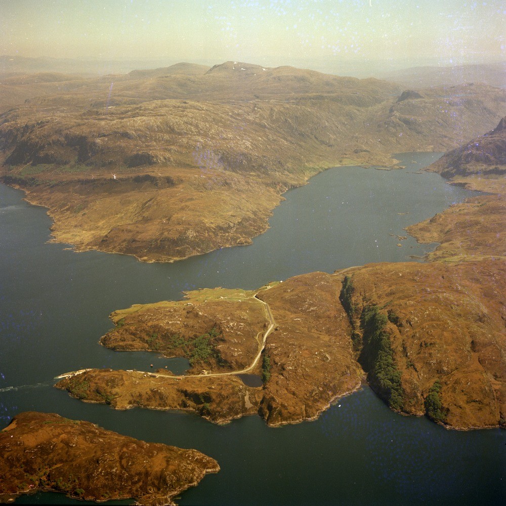
| Caption: | The glaciated valleys of Loch Glencoul (right) and Loch Glendhu (entrance on the left) whose waters fill the valleys overdeepened by glaciation and now produce a fiord-like topography. |
| Description: | The hummocky low ground between the two lochs is the Lewisian Gneiss basement, on which the Cambrian Basal Quartzite and Pipe Rock lie unconformably and form the prominent low scarp. Above this the break in slope marks the line of the Glencoul Thrust plane which brings Lewisian gneiss to rest upon Cambrian strata. View looking south-east. Kylestrome Ferry (Kylesku Ferry) is in the foreground on the left. |
| Date taken: | Wed Jan 01 00:00:00 GMT 1975 |
| Photographer: | Christie, A. |
| Copyright statement: | NERC |
| Acknowledgment: | This image was digitized with grant-in-aid from SCRAN the Scottish Cultural Resources Access Network |
| X longitude/easting: | 225500 |
| Y latitude/northing: | 933500 |
| Coordinate reference system, ESPG code: | 27700 (OSGB 1936 / British National Grid) |
| Orientation: | Square |
| Size: | 290.65 KB; 1000 x 1000 pixels; 85 x 85 mm (print at 300 DPI); 265 x 265 mm (screen at 96 DPI); |
| Average Rating: | Not yet rated |
| Categories: | Unsorted Images |
Loading...
Loading...
Reviews
There is currently no feedback