| P number: | P000839 |
|---|---|
| Old photograph number: | D02400 |
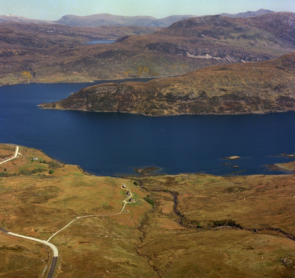
| Caption: | Loch Glencoul. Sutherland. |
| Description: | Beyond Loch Glendhu the lower ground is again formed by Lewisian gneiss but here it is overlain unconformably by Cambrian Basal Quartzite and Pipe Rock which form the prominent scarp feature with white screes. The peaty flat beyond the scarp follows the dip of the Pipe Rock and beyond that a set of grassy screes marks the outcrop of the zone of imbrication of Cambrian strata which lie under the Glencoul Thrust. The top of the hill is formed of Lewisian gneiss which has been brought forward by the thrust to rest on the Cambrian. In the foreground Lewisian gneiss stretches down to the shores of Loch Glencoul producing a characteristic hummocky, peaty terrain which is continued in the peninsula dividing Loch Glencoul from Loch Glendhu. The distant hills are mainly Lewisian. View looking north-east. |
| Date taken: | Wed Jan 01 00:00:00 GMT 1975 |
| Photographer: | Christie, A. |
| Copyright statement: | NERC |
| Acknowledgment: | This image was digitized with grant-in-aid from SCRAN the Scottish Cultural Resources Access Network |
| X longitude/easting: | 225500 |
| Y latitude/northing: | 933500 |
| Coordinate reference system, ESPG code: | 27700 (OSGB 1936 / British National Grid) |
| Orientation: | Landscape |
| Size: | 298.10 KB; 1000 x 942 pixels; 85 x 80 mm (print at 300 DPI); 265 x 249 mm (screen at 96 DPI); |
| Average Rating: | Not yet rated |
| Categories: | Unsorted Images |
Loading...
Loading...
Reviews
There is currently no feedback