| P number: | P212538 |
|---|---|
| Old photograph number: | A13485 |
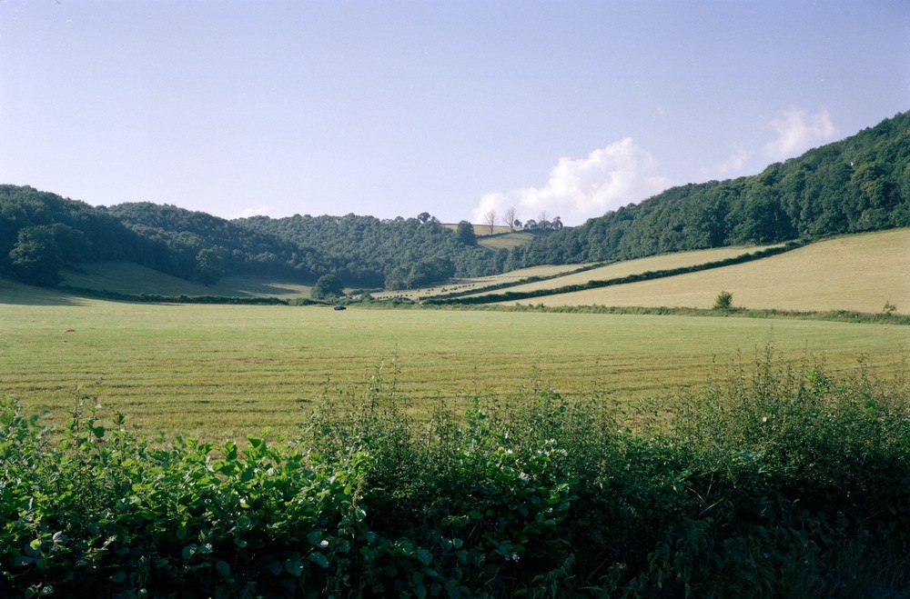
| Caption: | Tributary valley near Trostrey Hill, Gwent. |
| Description: | Tributary valley, south-east of Trostrey Hill. Rejuvenated dry valleys and misfit stream, Usk Inlier. In the upland areas of the Usk Inlier, which lay outside the late Devensian ice margin are a series of rejuvenated steep-sided dry valleys and tributaries comparable with similar examples from the Old Red Sandstone terrain, south-east of Usk. The valleys radiate from the major hills, for example Trostrey Hill in the centre far distance; are partially strike-controlled, and consist of short linear stretches separated by sharp 90-120 degree bends, e.g. by the baled hay. Such valleys may also have collected seasonal snow meltwater but any resultant gravel is now concealed by head. Two tributary valleys meet beneath Trostrey Hill (formed by the Llangibby Beds of the highest Ludlovian) and the downstream flat in the foreground contains a misfit stream on the right. |
| Date taken: | Sun Jan 01 00:00:00 GMT 1978 |
| Photographer: | Pulsford, J.M. |
| Copyright statement: | NERC |
| X longitude/easting: | 337490 |
| Y latitude/northing: | 203870 |
| Coordinate reference system, ESPG code: | 27700 (OSGB 1936 / British National Grid) |
| Orientation: | Landscape |
| Size: | 204.62 KB; 1000 x 659 pixels; 85 x 56 mm (print at 300 DPI); 265 x 174 mm (screen at 96 DPI); |
| Average Rating: | Not yet rated |
| Categories: | Unsorted Images |
Loading...
Loading...
Reviews
There is currently no feedback