| P number: | P000806 |
|---|---|
| Old photograph number: | D02357 |
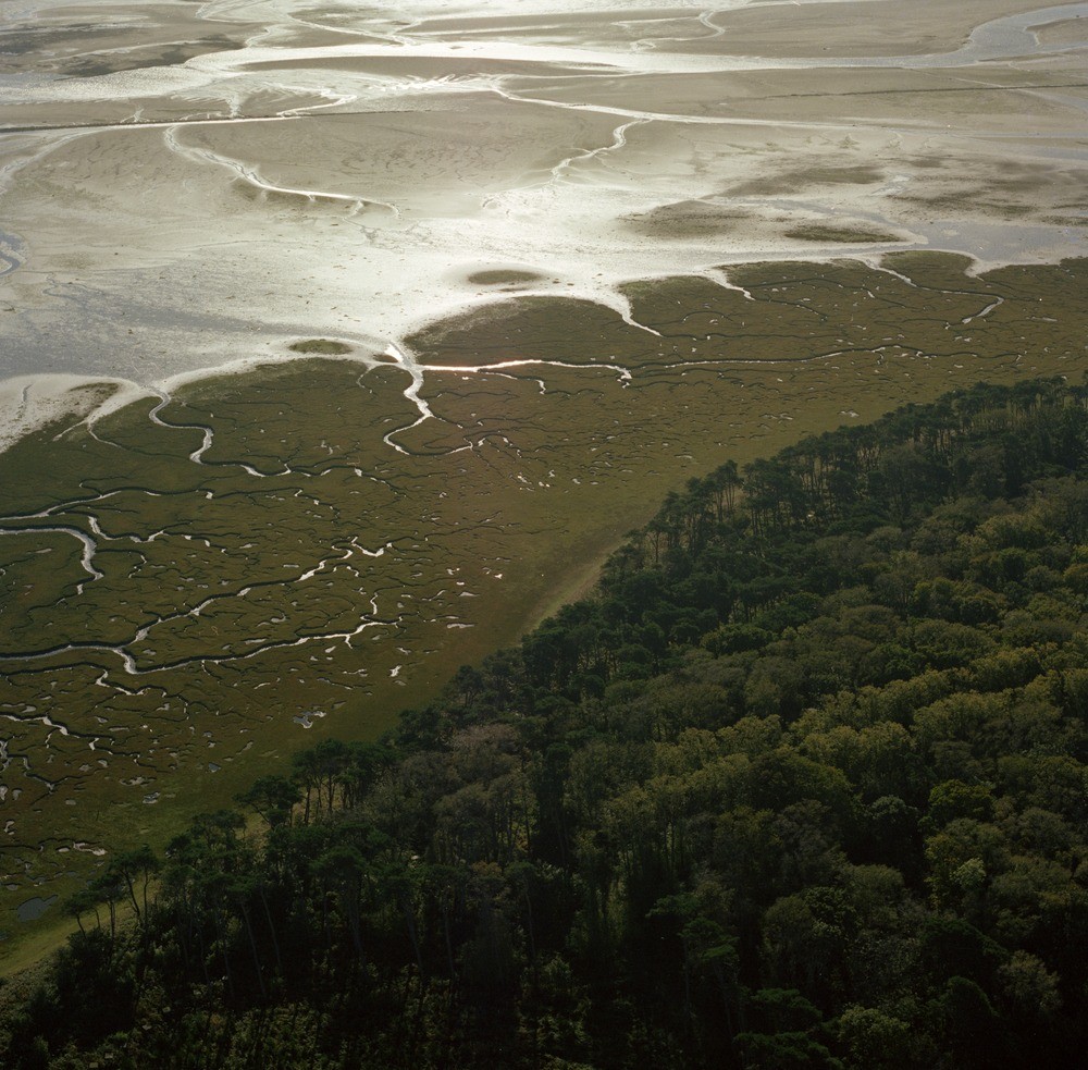
| Caption: | Oblique aerial view of Heckie's Hole, River Tyne. Looking south-south-east. The view shows the development of salt marsh in the River Tyne estuary area. |
| Description: | Oblique aerial view of Heckie's Hole, River Tyne. Looking south-south-east. The view shows the development of salt marsh in the River Tyne estuary area. The salt marsh represents the highest of the three estuary zones. It is a very flat area above high water mark, covered with vegetation and more or less dissected by creeks. Beyond in the photograph is the intertidal zone. The most conspicuous geomorphological feature is the system of tidal creeks and channels, these may extend across the lower intertidal slopes. Three main influencing factors on their distribution are the nature of the substratum, the type of plant cover and the tidal range. |
| Date taken: | Sat Jan 01 00:00:00 GMT 1977 |
| Photographer: | Christie, A. |
| Copyright statement: | NERC |
| Acknowledgment: | This image was digitized with grant-in-aid from SCRAN the Scottish Cultural Resources Access Network |
| X longitude/easting: | 363200 |
| Y latitude/northing: | 680000 |
| Coordinate reference system, ESPG code: | 27700 (OSGB 1936 / British National Grid) |
| Orientation: | Landscape |
| Size: | 282.61 KB; 1000 x 983 pixels; 85 x 83 mm (print at 300 DPI); 265 x 260 mm (screen at 96 DPI); |
| Average Rating: | Not yet rated |
| Categories: | Unsorted Images |
Loading...
Loading...
Reviews
There is currently no feedback