| P number: | P000805 |
|---|---|
| Old photograph number: | D02356 |
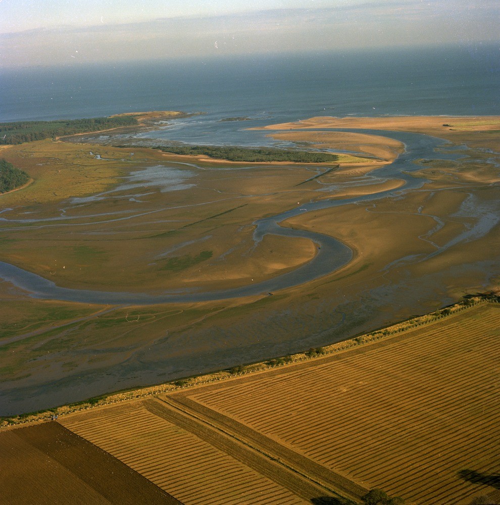
| Caption: | Oblique aerial view of the River Tyne. Looking north-north-east. East Lothian. Estuary sedimentation. Sand and shingle spits occur, one, Sandy Hirst, is vegetated. |
| Description: | Oblique aerial view of the River Tyne. Looking north-north-east. East Lothian. Estuary sedimentation. Sand and shingle spits occur, one, Sandy Hirst, is vegetated. Coastal inlets usually have three zones, above high water mark is salt marsh, between high and low water are tidal flats, normally bare of vegetation and dissected by channel floors and lastly the channel floors themselves, these are below low water mark. All three are represented on this view. Estuaries are one stage of a continuum between coastal lagoons and deltas, the formation of which depends on a range of factors such as form of original inlet, supply of river and marine sediments, river, wave and tidal regimes and water mixing characteristics. |
| Date taken: | Sat Jan 01 00:00:00 GMT 1977 |
| Photographer: | Christie, A. |
| Copyright statement: | NERC |
| Acknowledgment: | This image was digitized with grant-in-aid from SCRAN the Scottish Cultural Resources Access Network |
| X longitude/easting: | 363500 |
| Y latitude/northing: | 679500 |
| Coordinate reference system, ESPG code: | 27700 (OSGB 1936 / British National Grid) |
| Orientation: | Portrait |
| Size: | 281.21 KB; 990 x 1000 pixels; 84 x 85 mm (print at 300 DPI); 262 x 265 mm (screen at 96 DPI); |
| Average Rating: | Not yet rated |
| Categories: | Best of BGS Images/ Geological structures, Geoscience subjects/ Landforms, river/ Estuaries |
Loading...
Loading...
Reviews
There is currently no feedback