| P number: | P212476 |
|---|---|
| Old photograph number: | A13380 |
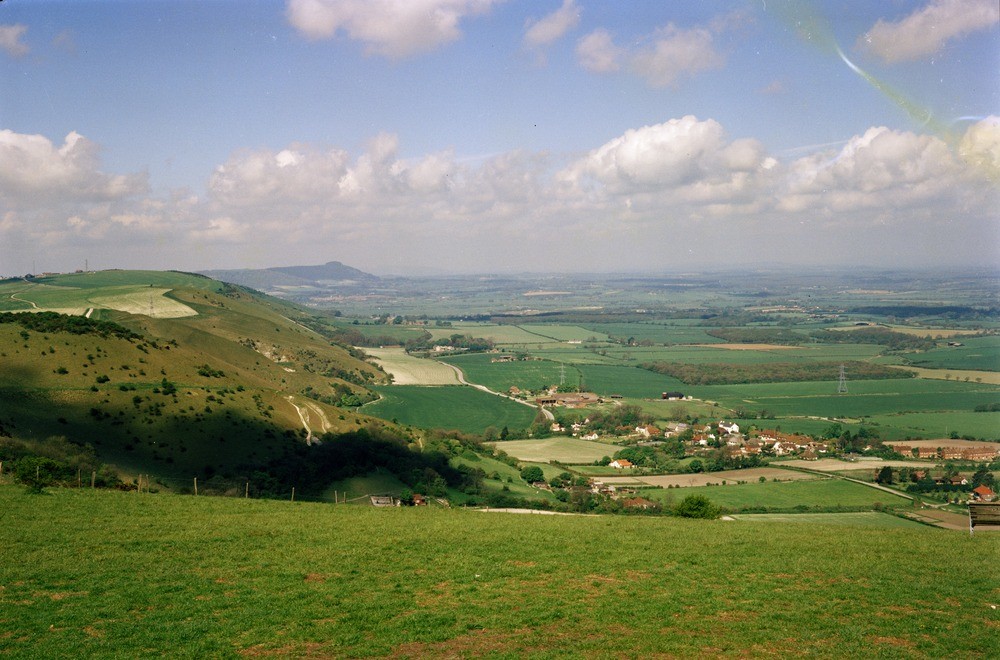
| Caption: | Devil's Dyke, Poynings, West Sussex. |
| Description: | View west along South Downs escarpment at the Devil's Dyke. The Upper and Middle Chalk form the top and steep face of the escarpment. The Lower Chalk forms the lowest slope of the escarpment and much of the more gently sloping arable fields to the left of the road. The road together with the villages of Edburton (middle distance) and Fulking (near distance) stand on the bench-feature formed by the Upper Greensand. The low-lying fields to the right are on the Gault outcrop. The prominent clump of trees at Chanctonbury Ring is on the escarpment crest beyond the Adur Gap. The escarpments and dip slopes of both the North and South Downs are characterized by coombes, the origin of which are of considerable interest. The simplest and most common types of coombe were formed by spring sapping and stream erosion probably during or immediately after glaciation when the normally porous chalk was rendered impermeable by the permafrost. The Devil's Dyke is an example of a more complex coombe. This resulted from the capture and subsequent rejuvenation of a dip-slope valley by a scarp-face spring and associated stream and has later been modified by periglacial processes. This type can only form when a dip-slope and scarp-face intersect. |
| Date taken: | Mon Jan 01 00:00:00 GMT 1979 |
| Photographer: | Jeffery, C.J. |
| Copyright statement: | NERC |
| X longitude/easting: | 525820 |
| Y latitude/northing: | 111060 |
| Coordinate reference system, ESPG code: | 27700 (OSGB 1936 / British National Grid) |
| Orientation: | Landscape |
| Size: | 195.86 KB; 1000 x 660 pixels; 85 x 56 mm (print at 300 DPI); 265 x 175 mm (screen at 96 DPI); |
| Average Rating: | Not yet rated |
| Categories: | Unsorted Images, Geoscience subjects/ Landforms, river/ Escarpments |
Loading...
Loading...
Reviews
There is currently no feedback