| P number: | P212473 |
|---|---|
| Old photograph number: | A13377 |
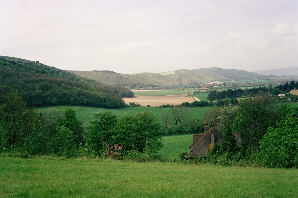
| Caption: | South Downs, Poynings. |
| Description: | South Downs, Poynings. South Downs escarpment, near Poynings. Upper and Middle Chalk form the face and the top of the escarpment with the lower slopes on Lower Chalk. The Upper Greensand forms a bench feature on which the road runs and on which the village of Fulking (middle distance) stands. The entrance to Devil's Dyke is in the valley - left foreground. |
| Date taken: | Mon Jan 01 00:00:00 GMT 1979 |
| Photographer: | Jeffery, C.J. |
| Copyright statement: | NERC |
| X longitude/easting: | 526690 |
| Y latitude/northing: | 111960 |
| Coordinate reference system, ESPG code: | 27700 (OSGB 1936 / British National Grid) |
| Orientation: | Landscape |
| Size: | 188.92 KB; 1000 x 666 pixels; 85 x 56 mm (print at 300 DPI); 265 x 176 mm (screen at 96 DPI); |
| Average Rating: | Not yet rated |
| Categories: | Unsorted Images, Geoscience subjects/ Landforms, river/ Escarpments |
Loading...
Loading...
Reviews
There is currently no feedback