| P number: | P000804 |
|---|---|
| Old photograph number: | D02355 |
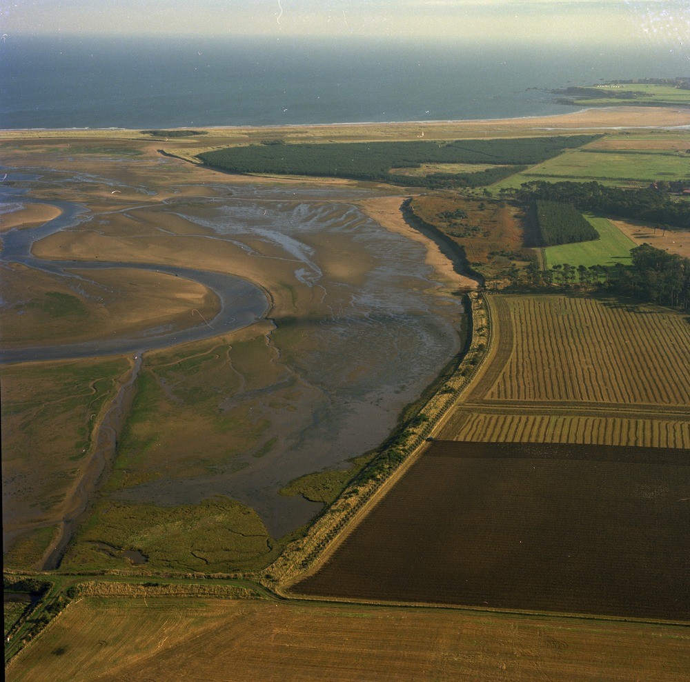
| Caption: | Oblique aerial view of the River Tyne. Looking east. East Lothian. Estuary sedimentation. Geomorphologically, the estuary zone is closely related to river flood plains. |
| Description: | Oblique aerial view of the River Tyne. Looking east. East Lothian. Estuary sedimentation. Geomorphologically, the estuary zone is closely related to river flood plains. Coastal inlets usually have three zones, above high water mark is salt marsh, between high and low water are tidal flats, normally bare of vegetation and dissected by channel floors and lastly the channel floors themselves, these are below low water mark. The latter two are represented on this view. From the point of view of coastal morphology, the most important forms of the subtidal zone are the channel systems caused by ebb and flood tidal channels separated by bars often sigmoidal in shape. |
| Date taken: | Sat Jan 01 00:00:00 GMT 1977 |
| Photographer: | Christie, A. |
| Copyright statement: | NERC |
| Acknowledgment: | This image was digitized with grant-in-aid from SCRAN the Scottish Cultural Resources Access Network |
| X longitude/easting: | 363000 |
| Y latitude/northing: | 679000 |
| Coordinate reference system, ESPG code: | 27700 (OSGB 1936 / British National Grid) |
| Orientation: | Landscape |
| Size: | 265.91 KB; 1000 x 989 pixels; 85 x 84 mm (print at 300 DPI); 265 x 262 mm (screen at 96 DPI); |
| Average Rating: | Not yet rated |
| Categories: | Unsorted Images |
Loading...
Loading...
Reviews
There is currently no feedback