| P number: | P000797 |
|---|---|
| Old photograph number: | D02346 |
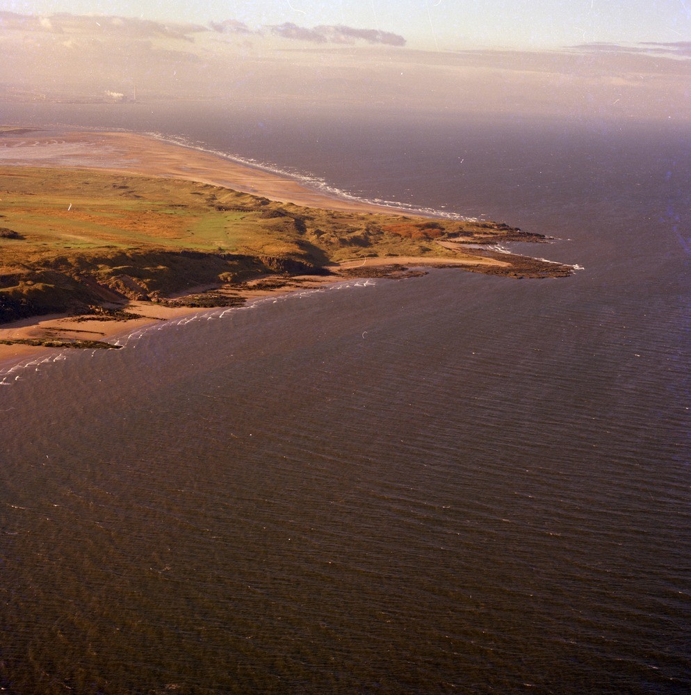
| Caption: | Oblique aerial view of Gullane, Black Rocks on the left and the headland Gullane Point, East Lothian. Looking south. Both are formed of intrusive dolerite sills. |
| Description: | Oblique aerial view of Gullane, Black Rocks on the left and the headland Gullane Point, East Lothian. Looking south. Both are formed of intrusive dolerite sills. The dolerite sills, technically teschenites, are intruded into the Carboniferous Calciferous Sandstone Measures. The two-pronged headland is caused by erosion in the softer sediments of Ironstone Bay between the two more resistant sills of Gullane Point and Hummell Rocks. The small bay, Ironstone Cove between Gullane Point and Hummell Rocks both sills forming the headlands, was so called due to mining of ironstone nodules found in the mudstones that dip gently under the teschenite sill of Gullane Point. |
| Date taken: | Sat Jan 01 00:00:00 GMT 1977 |
| Photographer: | Christie, A. |
| Copyright statement: | NERC |
| Acknowledgment: | This image was digitized with grant-in-aid from SCRAN the Scottish Cultural Resources Access Network |
| X longitude/easting: | 348500 |
| Y latitude/northing: | 685400 |
| Coordinate reference system, ESPG code: | 27700 (OSGB 1936 / British National Grid) |
| Orientation: | Portrait |
| Size: | 268.40 KB; 994 x 1000 pixels; 84 x 85 mm (print at 300 DPI); 263 x 265 mm (screen at 96 DPI); |
| Average Rating: | Not yet rated |
| Categories: | Unsorted Images |
Loading...
Loading...
Reviews
There is currently no feedback