| P number: | P000796 |
|---|---|
| Old photograph number: | D02345 |
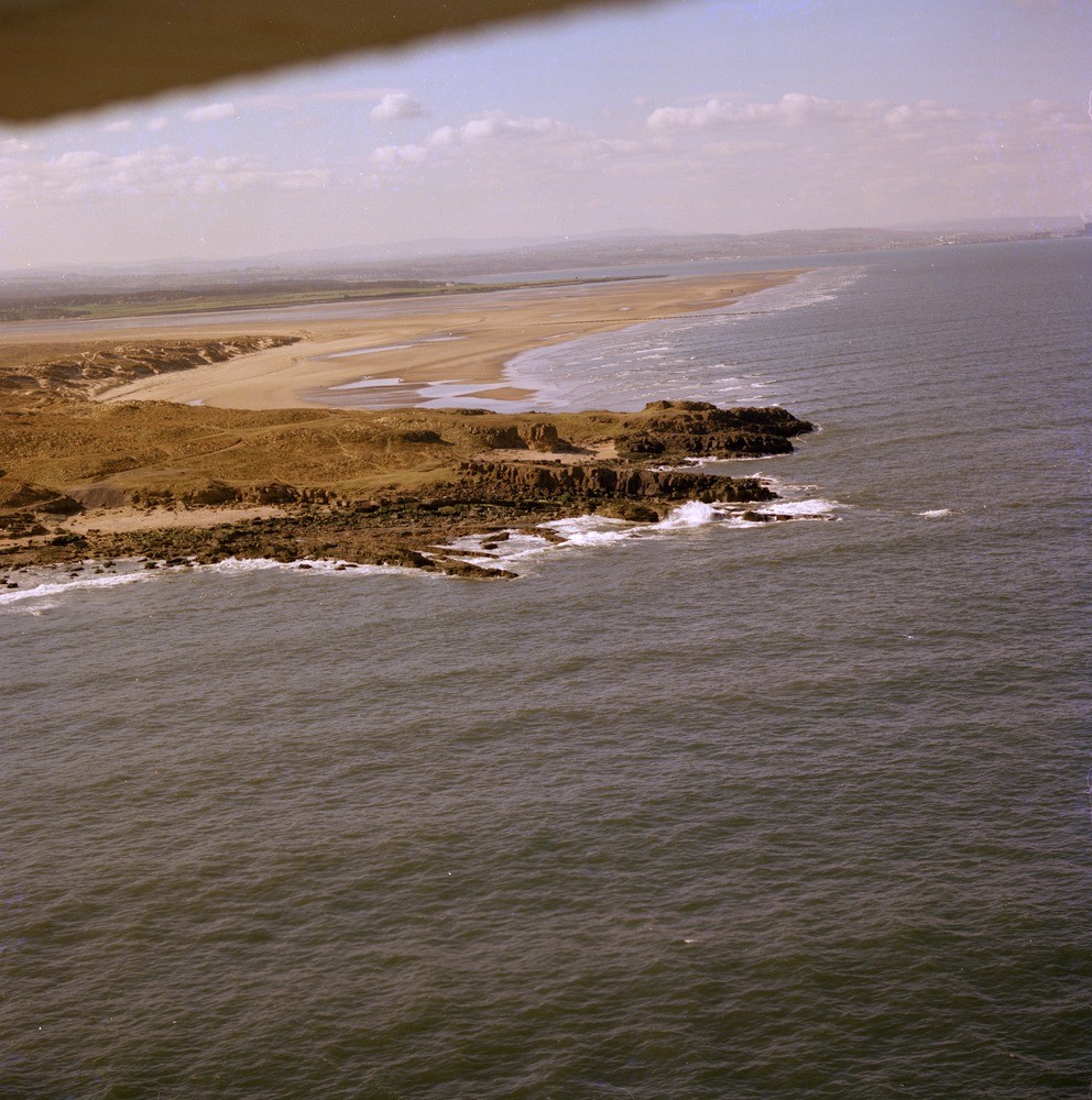
| Caption: | Oblique aerial view of Gullane Point, Gullane. East Lothian. Looking south-west showing a dolerite sill. |
| Description: | Oblique aerial view of Gullane Point, Gullane. East Lothian. Looking south-west showing a dolerite sill. The dolerite sill, technically a teschenite, is intruded into the Carboniferous Calciferous Sandstone Measures. As this igneous rock is much harder than the overlying and underlying sedimentary rocks it has withstood erosion better and so now forms a headland. |
| Date taken: | Sat Jan 01 00:00:00 GMT 1977 |
| Photographer: | Christie, A. |
| Copyright statement: | NERC |
| Acknowledgment: | This image was digitized with grant-in-aid from SCRAN the Scottish Cultural Resources Access Network |
| X longitude/easting: | 346100 |
| Y latitude/northing: | 683000 |
| Coordinate reference system, ESPG code: | 27700 (OSGB 1936 / British National Grid) |
| Orientation: | Portrait |
| Size: | 287.53 KB; 992 x 1000 pixels; 84 x 85 mm (print at 300 DPI); 262 x 265 mm (screen at 96 DPI); |
| Average Rating: | Not yet rated |
| Categories: | Unsorted Images |
Loading...
Loading...
Reviews
There is currently no feedback