| P number: | P000789 |
|---|---|
| Old photograph number: | D02278 |
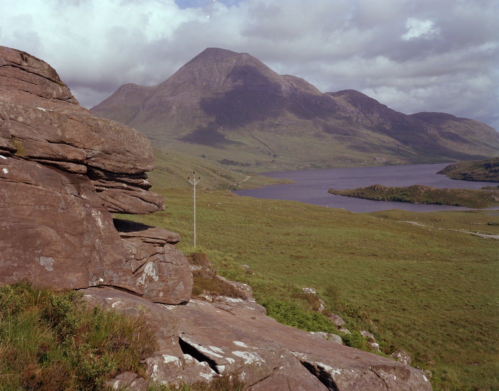
| Caption: | Photograph taken south-west of Stac Pollaidh looking south-east towards Cul Beag, a mountain of Torridonian sandstone. Loch Lurgainn is in the centre. |
| Description: | Photograph taken south-west of Stac Pollaidh looking south-east towards Cul Beag, a mountain of Torridonian sandstone. Loch Lurgainn is in the centre. Torridonian country. A typical Torridonian outcrop is seen in the foreground consisting of reddish-brown sandstone originally laid down in late Precambrian times (c. 1000-750 Ma.) in a terrestrial (land) environment under fluviatile conditions. |
| Date taken: | Thu Jan 01 00:00:00 GMT 1976 |
| Photographer: | Pulsford, J.M. |
| Copyright statement: | NERC |
| Acknowledgment: | This image was digitized with grant-in-aid from SCRAN the Scottish Cultural Resources Access Network |
| X longitude/easting: | 211300 |
| Y latitude/northing: | 909600 |
| Coordinate reference system, ESPG code: | 27700 (OSGB 1936 / British National Grid) |
| Orientation: | Landscape |
| Size: | 239.26 KB; 1000 x 784 pixels; 85 x 66 mm (print at 300 DPI); 265 x 207 mm (screen at 96 DPI); |
| Average Rating: | Not yet rated |
| Categories: | Unsorted Images, Geoscience subjects/ Stratigraphical/ Torridonian |
Loading...
Loading...
Reviews
There is currently no feedback