| P number: | P000781 |
|---|---|
| Old photograph number: | D02235 |
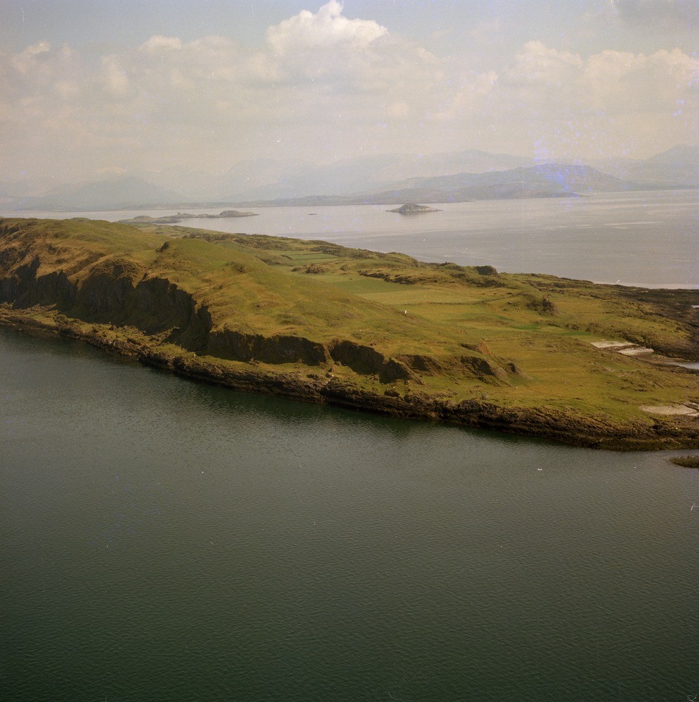
| Caption: | Oblique aerial view of the south end of the island of Lismore. Argyll and Bute. Along the coast is the Main Rock Platform, a Quaternary shore line and cliff. |
| Description: | Oblique aerial view of the south end of the island of Lismore. Argyll and Bute. Along the coast is the Main Rock Platform, a Quaternary shore line and cliff. The rocks belong to the Lismore Limestone Formation of the Blair Atholl Subgroup of the Dalradian Supergroup (Precambrian). They are a thick sequence of blue-grey flaggy limestones that repeatedly pass through a series of transitional beds into subordinate black slates. The whole island is crossed by a series of north-west - south-east trending Tertiary dykes derived from the Mull central igneous complex. |
| Date taken: | Thu Jan 01 00:00:00 GMT 1976 |
| Photographer: | Christie, A. |
| Copyright statement: | NERC |
| Acknowledgment: | This image was digitized with grant-in-aid from SCRAN the Scottish Cultural Resources Access Network |
| X longitude/easting: | 185500 |
| Y latitude/northing: | 640500 |
| Coordinate reference system, ESPG code: | 27700 (OSGB 1936 / British National Grid) |
| Orientation: | Portrait |
| Size: | 227.69 KB; 995 x 1000 pixels; 84 x 85 mm (print at 300 DPI); 263 x 265 mm (screen at 96 DPI); |
| Average Rating: | Not yet rated |
| Categories: | Unsorted Images |
Loading...
Loading...
Reviews
There is currently no feedback