| P number: | P212115 |
|---|---|
| Old photograph number: | A12812 |
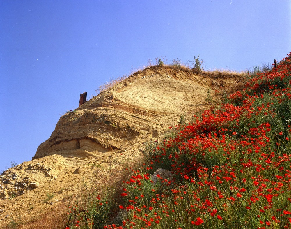
| Caption: | Sand and gravel-pit, the Folly, Ingham, 6.5 km. N. of Bury St. Edmunds. |
| Description: | Sand and gravel-pit, the Folly, Ingham, 6.5 km. N. of Bury St. Edmunds. Recumbent fold in glacial sand and gravel. The fold was formed either by glaciotectonics or by slumping in the fluvioglacial regime adjacent to the ice sheet. The cobble gravel some 4 m. below the fold suggests, also, the close proximity of the ice sheet during deposition. |
| Date taken: | Sat Jan 01 00:00:00 GMT 1977 |
| Photographer: | Evans, H.J. |
| Copyright statement: | NERC |
| X longitude/easting: | 585140 |
| Y latitude/northing: | 271530 |
| Coordinate reference system, ESPG code: | 27700 (OSGB 1936 / British National Grid) |
| Orientation: | Landscape |
| Size: | 337.36 KB; 1000 x 786 pixels; 85 x 67 mm (print at 300 DPI); 265 x 208 mm (screen at 96 DPI); |
| Average Rating: | Not yet rated |
| Categories: | Unsorted Images, Geoscience subjects/ Landforms, glaciation/ Glacial deposits, boulder clay, sand, gravel, Geoscience subjects/ Structural features/ Folding |
Loading...
Loading...
Reviews
There is currently no feedback