| P number: | P000765 |
|---|---|
| Old photograph number: | D02181 |
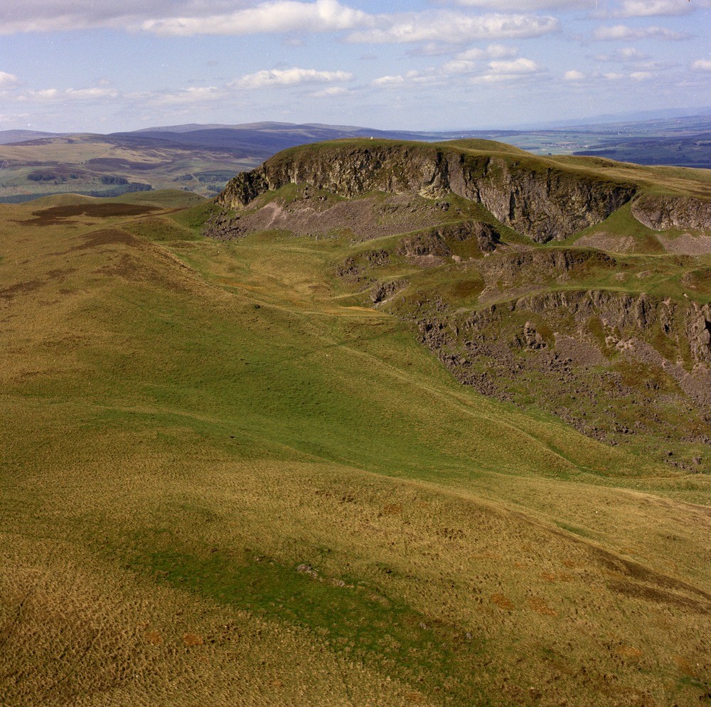
| Caption: | Oblique aerial view of Craig Rossie near Auchterader, taken from the east. The photograph shows a series of well-developed landslips just below the summit. A closer view. |
| Description: | Oblique aerial view of Craig Rossie near Auchterader, taken from the east. The photograph shows a series of well-developed landslips just below the summit. A closer view. Rhyodacite lava forming the summit of Craig Rossie is in its original unlandslipped position. The lower rocky scarps mark successively landslipped parts of the same flow. Joints formerly near vertical now dip away from the hill and the upper surfaces of the slipped masses are tilted backwards, both effects are presumably caused by rotation during movement. |
| Date taken: | Sat Jan 01 00:00:00 GMT 1977 |
| Photographer: | Christie, A. |
| Copyright statement: | NERC |
| Acknowledgment: | This image was digitized with grant-in-aid from SCRAN the Scottish Cultural Resources Access Network |
| X longitude/easting: | 299500 |
| Y latitude/northing: | 713500 |
| Coordinate reference system, ESPG code: | 27700 (OSGB 1936 / British National Grid) |
| Orientation: | Landscape |
| Size: | 403.66 KB; 1000 x 994 pixels; 85 x 84 mm (print at 300 DPI); 265 x 263 mm (screen at 96 DPI); |
| Average Rating: | Not yet rated |
| Categories: | Unsorted Images, Geoscience subjects/ Landforms, weathering/ Landslips |
Loading...
Loading...
Reviews
There is currently no feedback