| P number: | P000764 |
|---|---|
| Old photograph number: | D02179 |
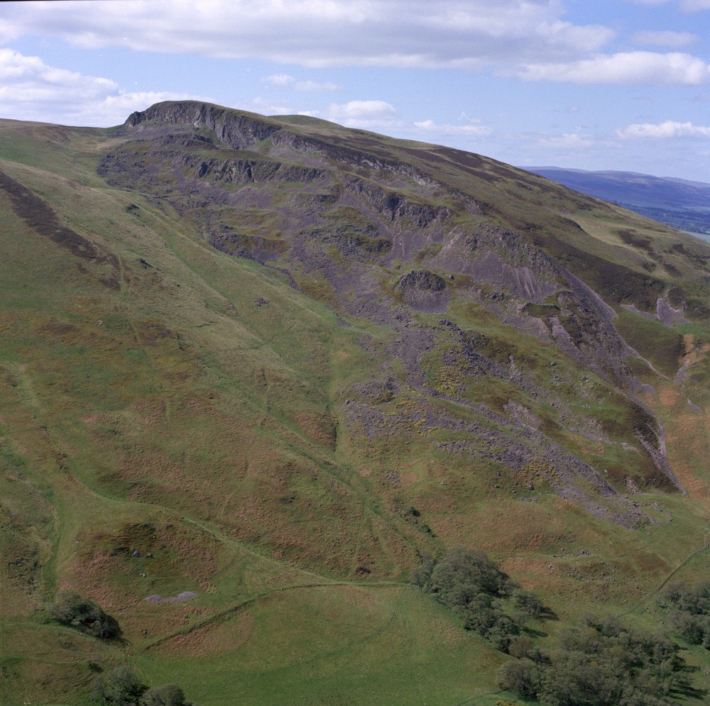
| Caption: | Oblique aerial view of Craig Rossie, taken from the east. The photograph shows a series of well-developed landslips just below the summit. |
| Description: | Oblique aerial view of Craig Rossie, taken from the east. The photograph shows a series of well-developed landslips just below the summit. Rhyodacite lava forming the summit of Craig Rossie is in its original unlandslipped position. The lower rocky scarps mark successively landslipped parts of the same flow. It appears that the rock has slid on planes discordant to the base of the rhyodacite, possibly fault-planes. It is thought that the slipping is largely late-glacial. |
| Date taken: | Sat Jan 01 00:00:00 GMT 1977 |
| Photographer: | Christie, A. |
| Copyright statement: | NERC |
| Acknowledgment: | This image was digitized with grant-in-aid from SCRAN the Scottish Cultural Resources Access Network |
| X longitude/easting: | 299500 |
| Y latitude/northing: | 713500 |
| Coordinate reference system, ESPG code: | 27700 (OSGB 1936 / British National Grid) |
| Orientation: | Landscape |
| Size: | 327.62 KB; 1000 x 995 pixels; 85 x 84 mm (print at 300 DPI); 265 x 263 mm (screen at 96 DPI); |
| Average Rating: | Not yet rated |
| Categories: | Unsorted Images |
Loading...
Loading...
Reviews
There is currently no feedback