| P number: | P000759 |
|---|---|
| Old photograph number: | D02173 |
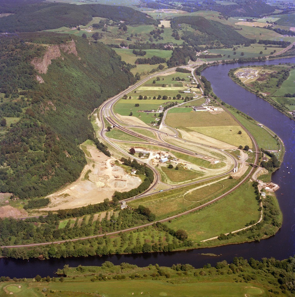
| Caption: | Oblique aerial view taken from above Friarton of Kinnoull Hill and the River Tay. Perthshire. |
| Description: | On Kinnoull Hill basic pyroxene-andesites form the crags while below is an acid volcanic conglomerate in a thick sequence, the latter is well exposed at the foot of the slopes while higher up, the conglomerates and the overlying lavas are intercalated. Note the building of the M85 motorway. Lower Devonian lavas form the south-facing scarp of Kinnoul Hill which overlooks low ground occupied by superficial deposits filling the buried channel of the River Tay. |
| Date taken: | Thu Jan 01 00:00:00 GMT 1976 |
| Photographer: | Christie, A. |
| Copyright statement: | NERC |
| Acknowledgment: | This image was digitized with grant-in-aid from SCRAN the Scottish Cultural Resources Access Network |
| X longitude/easting: | 312500 |
| Y latitude/northing: | 722000 |
| Coordinate reference system, ESPG code: | 27700 (OSGB 1936 / British National Grid) |
| Orientation: | Portrait |
| Size: | 400.67 KB; 995 x 1000 pixels; 84 x 85 mm (print at 300 DPI); 263 x 265 mm (screen at 96 DPI); |
| Average Rating: | Not yet rated |
| Categories: | Unsorted Images |
Loading...
Loading...
Reviews
There is currently no feedback