| P number: | P211760 |
|---|---|
| Old photograph number: | A12237 |
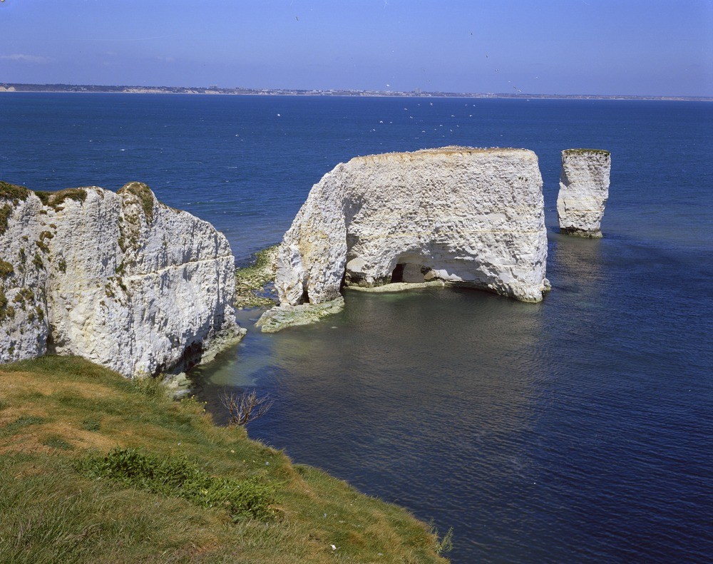
| Caption: | The Foreland, E. of Studland. Looking NNE. |
| Description: | The Foreland, E. of Studland. Looking NNE. Old Harry Rocks. These stacks have resulted from marine erosion of locally hard beds of Chalk. The large central gap was breached in the winter of 1920-21; the island stack so formed is now being reduced to smaller stacks by union of caves and collapse of natural arches. |
| Date taken: | Tue Jan 01 00:00:00 GMT 1974 |
| Photographer: | Pulsford, J.M. |
| Copyright statement: | NERC |
| X longitude/easting: | 405500 |
| Y latitude/northing: | 82500 |
| Coordinate reference system, ESPG code: | 27700 (OSGB 1936 / British National Grid) |
| Orientation: | Landscape |
| Size: | 285.66 KB; 1000 x 791 pixels; 85 x 67 mm (print at 300 DPI); 265 x 209 mm (screen at 96 DPI); |
| Average Rating: | Not yet rated |
| Categories: | Unsorted Images, Geoscience subjects/ Landforms, marine/ Stacks, Geoscience subjects/ Named locality, Geoscience subjects/ Economic geology/ Cement and lime, limestone quarries and chalk pits |
Loading...
Loading...
Reviews
There is currently no feedback