| P number: | P211757 |
|---|---|
| Old photograph number: | A12220 |
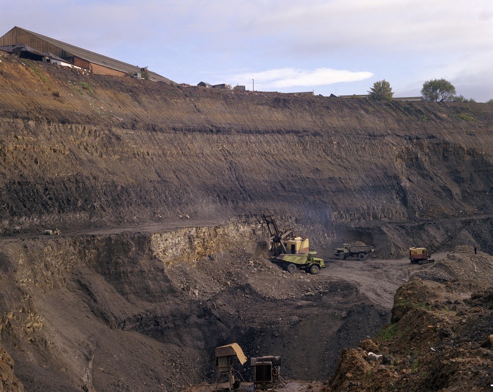
| Caption: | Brettell Lane, Brierley Hill. |
| Description: | Brettell Lane, Brierley Hill. Opencast section at Brettell Lane site. About 35-40 m. of Middle Coal Measures exposed comprising thin veneer of Etruria Marl on top of section. a) Brooch Coal (upper part) about 0.9-1.0 m. thick. b) Measures about 10 m. c) Stinking Coal about 0.6 m, dark to black shales about 4.5 m. (central parts). d) Measures, up to 15 m. thick. e) Thick Coal, up to 12 m. thick (partly exposed lower left). |
| Date taken: | Tue Jan 01 00:00:00 GMT 1974 |
| Photographer: | Evans, H.J. |
| Copyright statement: | NERC |
| X longitude/easting: | 390550 |
| Y latitude/northing: | 286050 |
| Coordinate reference system, ESPG code: | 27700 (OSGB 1936 / British National Grid) |
| Orientation: | Landscape |
| Size: | 283.80 KB; 1000 x 796 pixels; 85 x 67 mm (print at 300 DPI); 265 x 211 mm (screen at 96 DPI); |
| Average Rating: | Not yet rated |
| Categories: | Unsorted Images, Geoscience subjects/ Economic geology/ Coal, Geoscience subjects/ Economic geology/ Quarries, opencast |
Loading...
Loading...
Reviews
There is currently no feedback