| P number: | P211751 |
|---|---|
| Old photograph number: | A12214 |
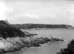
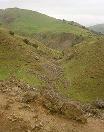
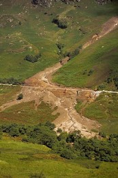
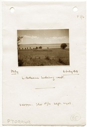
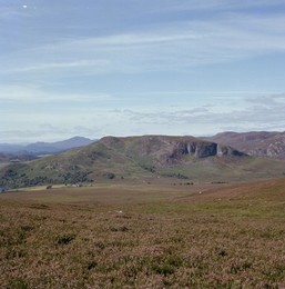
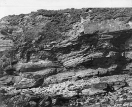
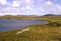
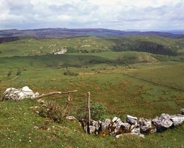
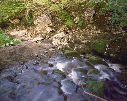
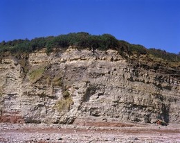
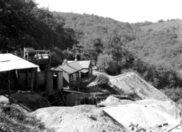
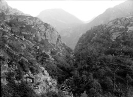
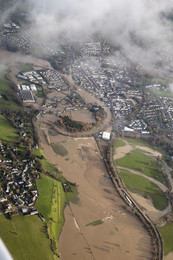
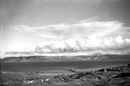
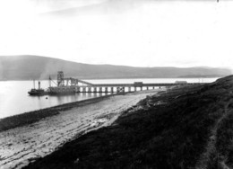
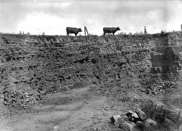
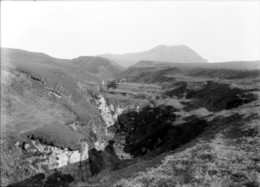
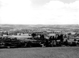
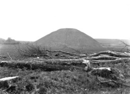
| Caption: | Hay Farm, Telford. Looking W. |
| Description: | Hay Farm, Telford. Looking W. Ironbridge Gorge from Hay Farm. The photograph was taken from the feature formed by the basal Brookside Rock of the Keele Beds; the wooded area to the right is Lloyd's Coppice where extensive landslips are developed in the silty mudstones of the Coalport Formation. Between Ironbridge Village (far right) and Buildwas Power Station the Wenlock Limestone forms a feature either side of the gorge. On the left bank of the river outcrop Lower Coal Measures and Hadley Formation, the latter providing red clay from which tiles were once manufactured in the large factory beside the river. |
| Date taken: | Tue Jan 01 00:00:00 GMT 1974 |
| Photographer: | Evans, H.J. |
| Copyright statement: | NERC |
| X longitude/easting: | 319630 |
| Y latitude/northing: | 302960 |
| Coordinate reference system, ESPG code: | 27700 (OSGB 1936 / British National Grid) |
| Orientation: | Landscape |
| Size: | 248.44 KB; 1000 x 784 pixels; 85 x 66 mm (print at 300 DPI); 265 x 207 mm (screen at 96 DPI); |
| Average Rating: | Not yet rated |
| Categories: | Unsorted Images |
Loading...
Loading...
Reviews
There is currently no feedback