| P number: | P000720 |
|---|---|
| Old photograph number: | D02047 |
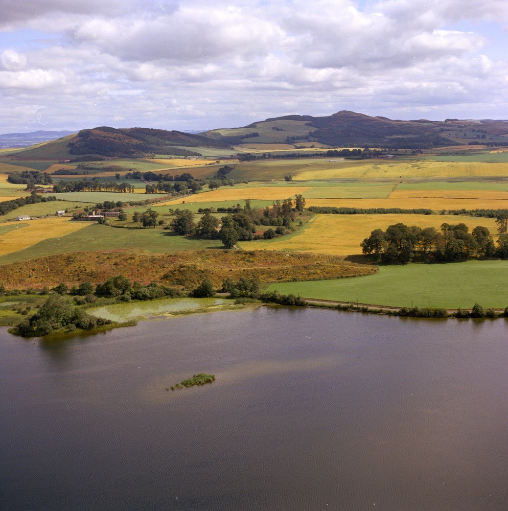
| Caption: | Oblique aerial view of Lindores Loch, looking north-east towards Glenduckie Hill and Norman's Law. Fifeshire. |
| Description: | The esker, the narrow, low, sinuous ridge with rough pasture, consists of sands and gravels and was deposited from a subglacial or englacial stream flowing between the ice walls or in an ice tunnel. Note the abrupt end of the esker. The centre section of an esker ridge that is situated on the east shore of the loch. The loch itself is a kettle hole. Both features are glacial landforms. |
| Date taken: | Thu Jan 01 00:00:00 GMT 1976 |
| Photographer: | Christie, A. |
| Copyright statement: | NERC |
| Acknowledgment: | This image was digitized with grant-in-aid from SCRAN the Scottish Cultural Resources Access Network |
| X longitude/easting: | 326400 |
| Y latitude/northing: | 716500 |
| Coordinate reference system, ESPG code: | 27700 (OSGB 1936 / British National Grid) |
| Orientation: | Portrait |
| Size: | 274.26 KB; 994 x 1000 pixels; 84 x 85 mm (print at 300 DPI); 263 x 265 mm (screen at 96 DPI); |
| Average Rating: | Not yet rated |
| Categories: | Unsorted Images |
Loading...
Loading...
Reviews
There is currently no feedback