| P number: | P000717 |
|---|---|
| Old photograph number: | D02042 |
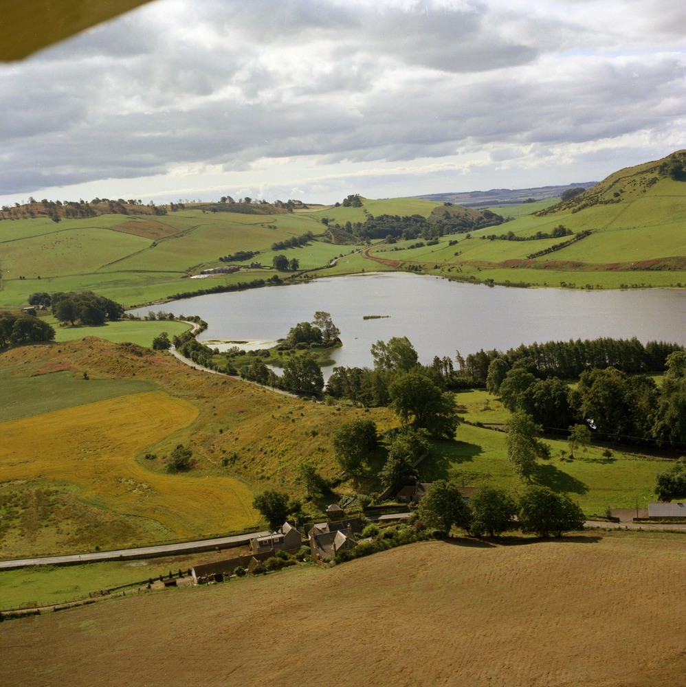
| Caption: | Oblique aerial view looking south-east, Lindores Village in foreground. Fifeshire. On the east side of the loch is an esker while the loch itself is in a kettle hole. |
| Description: | Oblique aerial view looking south-east, Lindores Village in foreground. Fifeshire. On the east side of the loch is an esker while the loch itself is in a kettle hole. The esker is the long, narrow sinuous ridge running near the loch. It consists of sands and gravels and was deposited from a subglacial or englacial stream flowing between the ice walls or in an ice tunnel. The kettle hole, a depression in the ground, was formed when a large mass of stagnant ice covered by drift melted leaving a hollow that filled with water. |
| Date taken: | Thu Jan 01 00:00:00 GMT 1976 |
| Photographer: | Christie, A. |
| Copyright statement: | NERC |
| Acknowledgment: | This image was digitized with grant-in-aid from SCRAN the Scottish Cultural Resources Access Network |
| X longitude/easting: | 333200 |
| Y latitude/northing: | 720300 |
| Coordinate reference system, ESPG code: | 27700 (OSGB 1936 / British National Grid) |
| Orientation: | Portrait |
| Size: | 302.04 KB; 998 x 1000 pixels; 84 x 85 mm (print at 300 DPI); 264 x 265 mm (screen at 96 DPI); |
| Average Rating: | Not yet rated |
| Categories: | Unsorted Images |
Loading...
Loading...
Reviews
There is currently no feedback