| P number: | P000712 |
|---|---|
| Old photograph number: | D02034 |
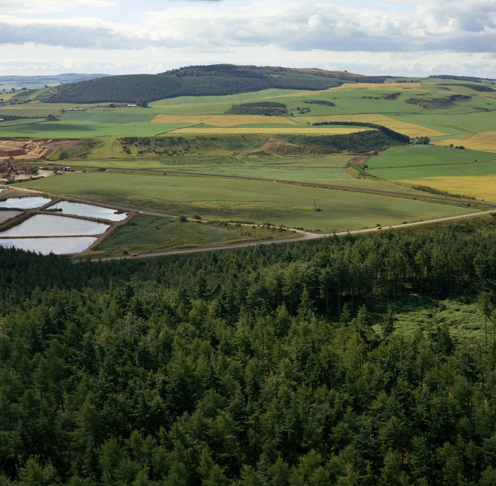
| Caption: | Oblique aerial view of the kame terrace at North Straiton (west pit), south-east of Wormit. Fife Region. Looking south-west. The flat-topped kame terrace can be seen beyond the railway. The level ground in front is the alluvium of the Motray Water. |
| Description: | Oblique aerial view of the kame terrace at North Straiton (west pit), south-east of Wormit. Fife Region. Looking south-west. The flat-topped kame terrace can be seen beyond the railway. The level ground in front is the alluvium of the Motray Water. The kame terrace, a continuous valley-side landform consists of fluvioglacial sands and gravels, an important resource in the area. On the extreme left the terrace is commercially worked, in front are the settling ponds. |
| Date taken: | Wed Jan 01 00:00:00 GMT 1975 |
| Photographer: | Christie, A. |
| Copyright statement: | NERC |
| Acknowledgment: | This image was digitized with grant-in-aid from SCRAN the Scottish Cultural Resources Access Network |
| X longitude/easting: | 341800 |
| Y latitude/northing: | 723800 |
| Coordinate reference system, ESPG code: | 27700 (OSGB 1936 / British National Grid) |
| Orientation: | Landscape |
| Size: | 311.26 KB; 1000 x 981 pixels; 85 x 83 mm (print at 300 DPI); 265 x 260 mm (screen at 96 DPI); |
| Average Rating: | Not yet rated |
| Categories: | Unsorted Images |
Loading...
Loading...
Reviews
There is currently no feedback