| P number: | P000711 |
|---|---|
| Old photograph number: | D02022 |
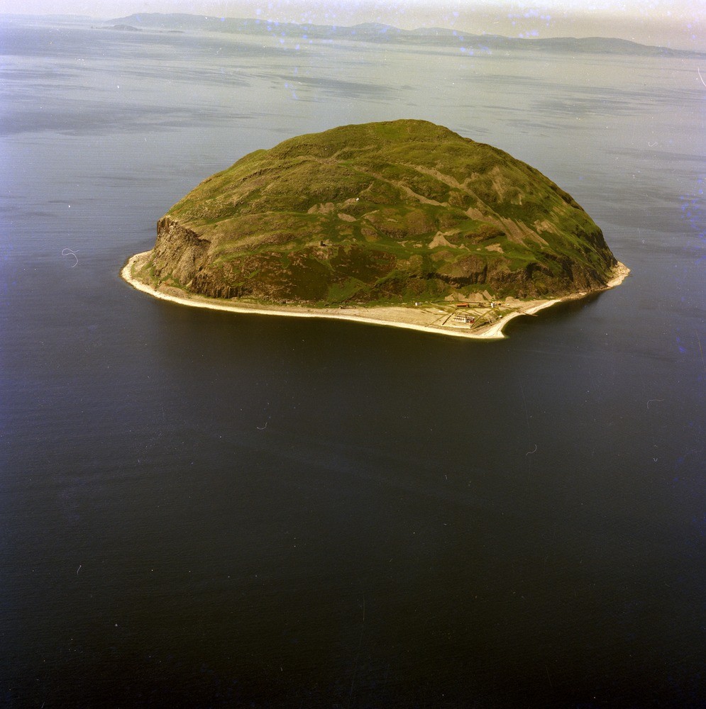
| Caption: | Oblique aerial view of the island of Ailsa Craig. Looking west. The flat triangular area in the foreground is a raised beach. The remains of the castle can just be seen. |
| Description: | Oblique aerial view of the island of Ailsa Craig. Looking west. The flat triangular area in the foreground is a raised beach. The remains of the castle can just be seen. The raised beach has a degraded surface which varies from 7 m. to 12 m. above sea level, an altitude that fits the local isobase of the main Postglacial Flandrian marine transgression of 8000 years BP. The buildings on the raised beach are mainly those of the lighthouse complex. |
| Date taken: | Thu Jan 01 00:00:00 GMT 1976 |
| Photographer: | Christie, A. |
| Copyright statement: | NERC |
| Acknowledgment: | This image was digitized with grant-in-aid from SCRAN the Scottish Cultural Resources Access Network |
| X longitude/easting: | 202500 |
| Y latitude/northing: | 600500 |
| Coordinate reference system, ESPG code: | 27700 (OSGB 1936 / British National Grid) |
| Orientation: | Portrait |
| Size: | 226.78 KB; 995 x 1000 pixels; 84 x 85 mm (print at 300 DPI); 263 x 265 mm (screen at 96 DPI); |
| Average Rating: | Not yet rated |
| Categories: | Best of BGS Images/ Landscapes |
Loading...
Loading...
Reviews
There is currently no feedback