| P number: | P000709 |
|---|---|
| Old photograph number: | D02020 |
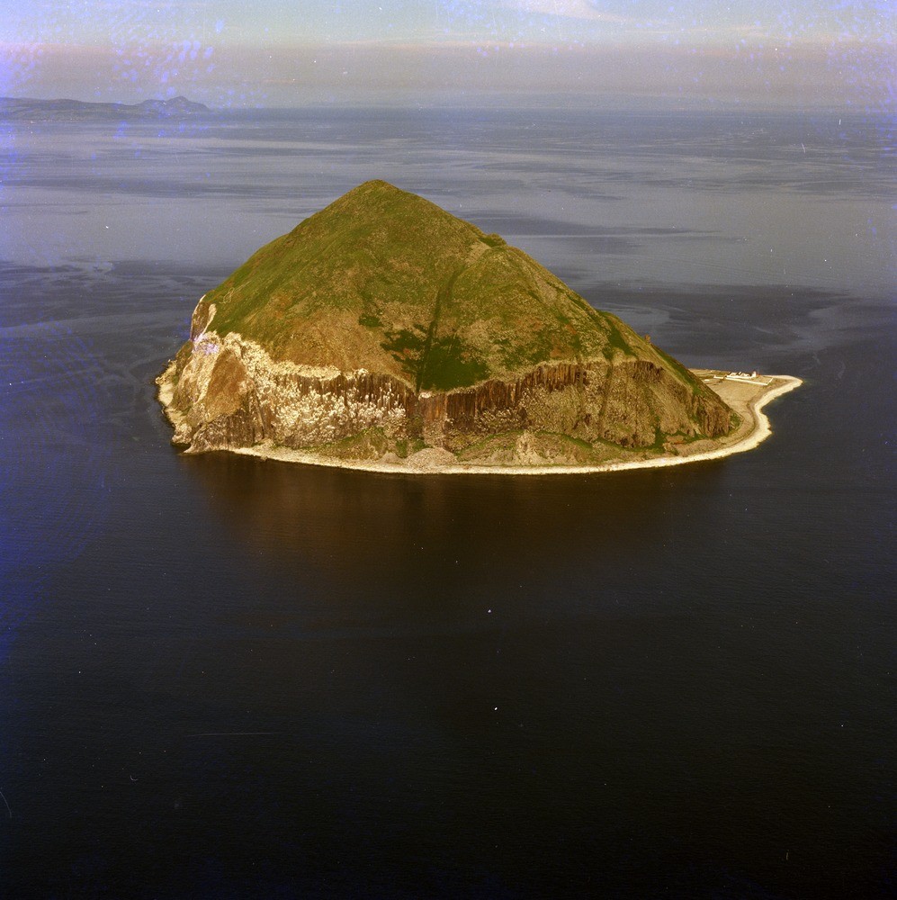
| Caption: | Oblique aerial view of the south end of the island of Ailsa Craig. Looking north-east. |
| Description: | The spectacular sea cliffs on the north, west and south of the island are the product of marine erosion although for the most part the cliff foot is now about 5 to 10 m. above sea level and so marks a raised shoreline. The Holy Island intrusion can be seen in the far distance. In the centre is the 'Rotten Nick' a prominent slack (depression) denuded along a vertical dolerite dyke and pseudo-columnar microgranite cliffs. Other traces of dykes can be seen to the right. |
| Date taken: | Thu Jan 01 00:00:00 GMT 1976 |
| Photographer: | Christie, A. |
| Copyright statement: | NERC |
| Acknowledgment: | This image was digitized with grant-in-aid from SCRAN the Scottish Cultural Resources Access Network |
| X longitude/easting: | 202500 |
| Y latitude/northing: | 600500 |
| Coordinate reference system, ESPG code: | 27700 (OSGB 1936 / British National Grid) |
| Orientation: | Portrait |
| Size: | 231.29 KB; 997 x 1000 pixels; 84 x 85 mm (print at 300 DPI); 264 x 265 mm (screen at 96 DPI); |
| Average Rating: | Not yet rated |
| Categories: | Unsorted Images |
Loading...
Loading...
Reviews
There is currently no feedback