| P number: | P211507 |
|---|---|
| Old photograph number: | A11932 |
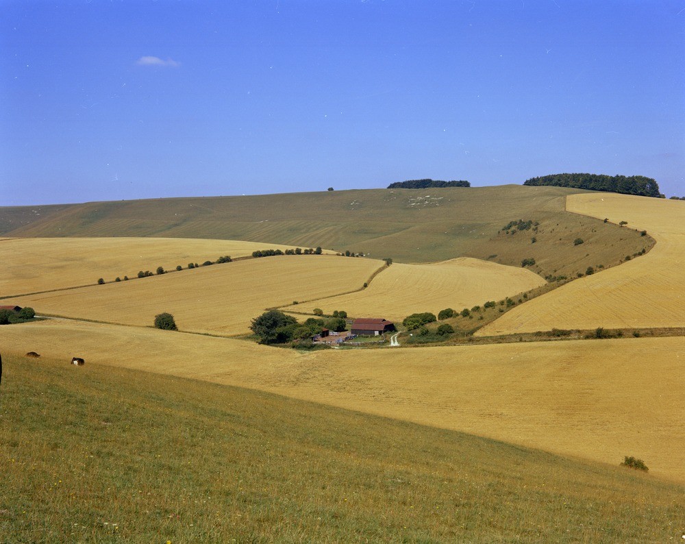
| Caption: | Devil's Punch Bowl and Crowhole Bottom. Looking N. |
| Description: | Devil's Punch Bowl and Crowhole Bottom. Looking N. Chalk topography. The feature of the Chalk Rock (i.e. basal Upper Chalk) can be seen at the top of the ridge on the skyline whilst the Melbourn Rock (basal Middle Chalk) forms the rounded features above the barns in the valley. |
| Date taken: | Thu Jan 01 00:00:00 GMT 1970 |
| Photographer: | Pulsford, J.M. |
| Copyright statement: | NERC |
| X longitude/easting: | 435500 |
| Y latitude/northing: | 184500 |
| Coordinate reference system, ESPG code: | 27700 (OSGB 1936 / British National Grid) |
| Orientation: | Landscape |
| Size: | 199.14 KB; 1000 x 794 pixels; 85 x 67 mm (print at 300 DPI); 265 x 210 mm (screen at 96 DPI); |
| Average Rating: | Not yet rated |
| Categories: | Unsorted Images, Geoscience subjects/ General views |
Loading...
Loading...
Reviews
There is currently no feedback