| P number: | P000705 |
|---|---|
| Old photograph number: | D02016 |
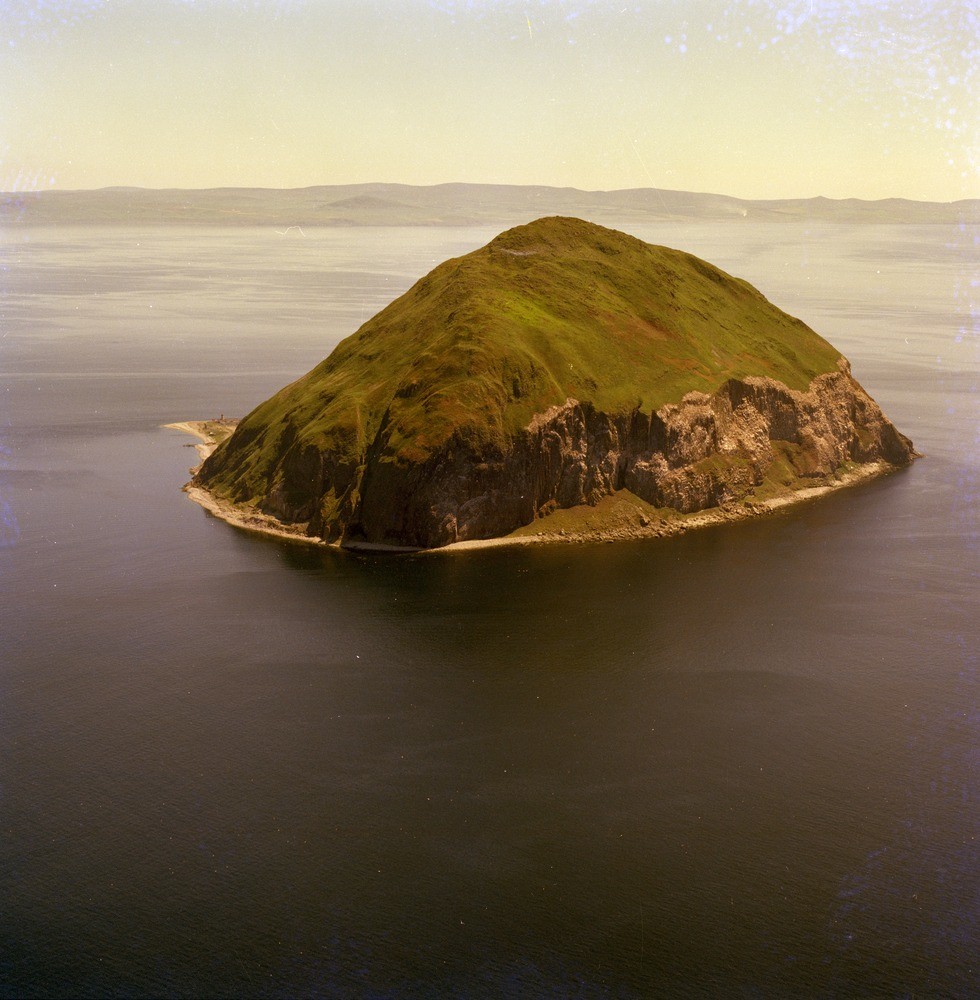
| Caption: | Oblique aerial view of the island of Ailsa Craig. Looking south-south-east. The island is 16 km. west of Girvan and 20 km. south of Bennan Head, Arran and forms an imposing feature in the approaches to the Firth of Clyde. |
| Description: | Oblique aerial view of the island of Ailsa Craig. Looking south-south-east. The island is 16 km. west of Girvan and 20 km. south of Bennan Head, Arran and forms an imposing feature in the approaches to the Firth of Clyde. Ailsa Craig is a small precipitous island approximately 1.2 km. in diameter with cliffs rising from the sea to a height of about 340 m. above O.D. This Tertiary boss is formed of an arfvedsonite-aegirine-microgranite intruded by vertical dyke swarms of olivine to alkaline olivine-dolerite with basalt margins. The island is famous geologically for the origin of 'marker' erratics of Ailsa Craig microgranite found in the glacial deposits over a wide area around the Irish Sea and as far south as Pembroke. Being distinctive in appearance it is easily identified in till deposits. |
| Date taken: | Thu Jan 01 00:00:00 GMT 1976 |
| Photographer: | Christie, A. |
| Copyright statement: | NERC |
| Acknowledgment: | This image was digitized with grant-in-aid from SCRAN the Scottish Cultural Resources Access Network |
| X longitude/easting: | 202500 |
| Y latitude/northing: | 600500 |
| Coordinate reference system, ESPG code: | 27700 (OSGB 1936 / British National Grid) |
| Orientation: | Portrait |
| Size: | 227.80 KB; 980 x 1000 pixels; 83 x 85 mm (print at 300 DPI); 259 x 265 mm (screen at 96 DPI); |
| Average Rating: | Not yet rated |
| Categories: | Best of BGS Images/ Landscapes, Geoscience subjects/ Named locality |
Loading...
Loading...
Reviews
There is currently no feedback