| P number: | P000699 |
|---|---|
| Old photograph number: | D01927 |
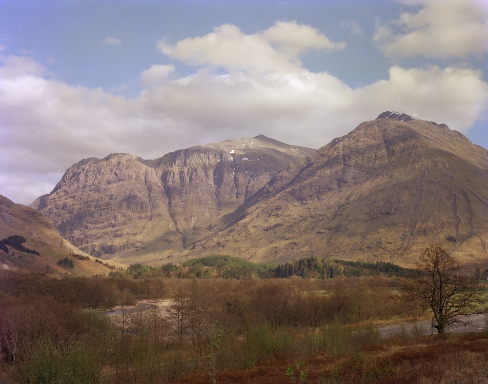
| Caption: | West face of Aonach Dubh and An t-Sron from Forestry Commission camp site. Glen Coe. Inverness-shire. |
| Description: | The upper cliffs of Aonach Dubh (pale) are rhyolite lavas resting on lavas of basic andesite, all of Lower Old Red Sandstone age. An t-Sron (on right) is composed principally of granite forming the Glen Coe Ring Fault Intrusion. The Glen Coe Ring Fault runs along the prominent gulley seen on left slopes of An t-Sron. The Glen Coe cauldron subsidence is a volcanic sequence of rhyolites, andesites and ignimbrites preserved in a downfaulted block within an elliptical ring fracture. The cauldron is 9 miles by 5 and has some thousands of feet downthrow. Paler rhyolite lavas and ignimbrites resting on lavas of basic basalts and andesites in the cliffs of Aonach Dubh. Part of the Glen Coe cauldron subsidence. |
| Date taken: | Thu Jan 01 00:00:00 GMT 1976 |
| Photographer: | Bennett, A. |
| Copyright statement: | NERC |
| Acknowledgment: | This image was digitized with grant-in-aid from SCRAN the Scottish Cultural Resources Access Network |
| X longitude/easting: | 211200 |
| Y latitude/northing: | 757700 |
| Coordinate reference system, ESPG code: | 27700 (OSGB 1936 / British National Grid) |
| Orientation: | Landscape |
| Size: | 207.29 KB; 1000 x 787 pixels; 85 x 67 mm (print at 300 DPI); 265 x 208 mm (screen at 96 DPI); |
| Average Rating: | Not yet rated |
| Categories: | Best of BGS Images/ Landscapes |
Loading...
Loading...
Reviews
There is currently no feedback