| P number: | P000697 |
|---|---|
| Old photograph number: | D01912 |
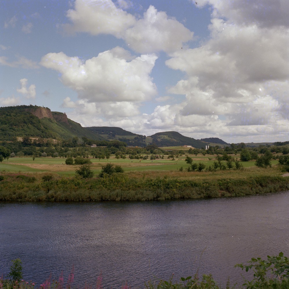
| Caption: | The western Sidlaw Hills from the south bank of the River Tay east of Friarton. Perthshire. Composed of Lower Devonian rocks |
| Description: | The western Sidlaw Hills from the south bank of the River Tay east of Friarton. Perthshire. Composed of Lower Devonian rocks North-west dipping Lower Devonian basic andesite from the rocky scarps of Kinnoull Hill. The low ground, downfaulted by the North Tay Fault, is formed by Quaternary sediments which occupy the buried channel of the River Tay. During the Lower Devonian there was a major basin aligned north-east - south-west into which thick sedimentary sequences were deposited, into which these thick piles of andesite lava were erupted. It is thought that the volcanic activity was related to subduction associated with the closure of an ancient sea called the Iapetus Ocean. |
| Date taken: | Thu Jan 01 00:00:00 GMT 1976 |
| Photographer: | Christie, A. |
| Copyright statement: | NERC |
| Acknowledgment: | This image was digitized with grant-in-aid from SCRAN the Scottish Cultural Resources Access Network |
| X longitude/easting: | 312500 |
| Y latitude/northing: | 721500 |
| Coordinate reference system, ESPG code: | 27700 (OSGB 1936 / British National Grid) |
| Orientation: | Portrait |
| Size: | 265.13 KB; 998 x 1000 pixels; 84 x 85 mm (print at 300 DPI); 264 x 265 mm (screen at 96 DPI); |
| Average Rating: | Not yet rated |
| Categories: | Unsorted Images |
Loading...
Loading...
Reviews
There is currently no feedback