| P number: | P000696 |
|---|---|
| Old photograph number: | D01910 |
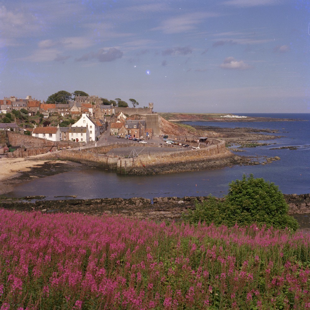
| Caption: | Crail Harbour. Fifeshire. Calciferous Sandstone Measures of Lower Carboniferous age. In the vicinity of the harbour are the Crail Harbour Marine Band and just to the east of the harbour, the Crail Harbour Fault. |
| Description: | Crail Harbour. Fifeshire. Calciferous Sandstone Measures of Lower Carboniferous age. In the vicinity of the harbour are the Crail Harbour Marine Band and just to the east of the harbour, the Crail Harbour Fault. Between the Pans Fault and the Crail Harbour Fault (the latter situated beyond the harbour) lies the Crail section of the Calciferous Sandstone Measures. At the top of this section, in the cliff by the harbour lies the Crail Harbour Marine Band. It consists of three metres of mudstone with bands of ironstone and decalcified limestone and a 30 cm. bed of crinoidal limestone at its base. Crail Harbour Marine Band has a rich fauna with brachiopods, molluscs and crinoids. The Crail Harbour Fault has a downthrow, suggested by the stratigraphy, of at least 200 metres. The fault plane dips in a south-westerly direction and at a moderate angle and is associated with a belt of weak shear-jointing about 0.6 metres wide. |
| Date taken: | Tue Jan 01 00:00:00 GMT 1974 |
| Photographer: | Christie, A. |
| Copyright statement: | NERC |
| Acknowledgment: | This image was digitized with grant-in-aid from SCRAN the Scottish Cultural Resources Access Network |
| X longitude/easting: | 361500 |
| Y latitude/northing: | 707500 |
| Coordinate reference system, ESPG code: | 27700 (OSGB 1936 / British National Grid) |
| Orientation: | Portrait |
| Size: | 348.38 KB; 999 x 1000 pixels; 85 x 85 mm (print at 300 DPI); 264 x 265 mm (screen at 96 DPI); |
| Average Rating: | Not yet rated |
| Categories: | Best of BGS Images/ Landscapes |
Loading...
Loading...
Reviews
There is currently no feedback