| P number: | P211376 |
|---|---|
| Old photograph number: | A11796 |
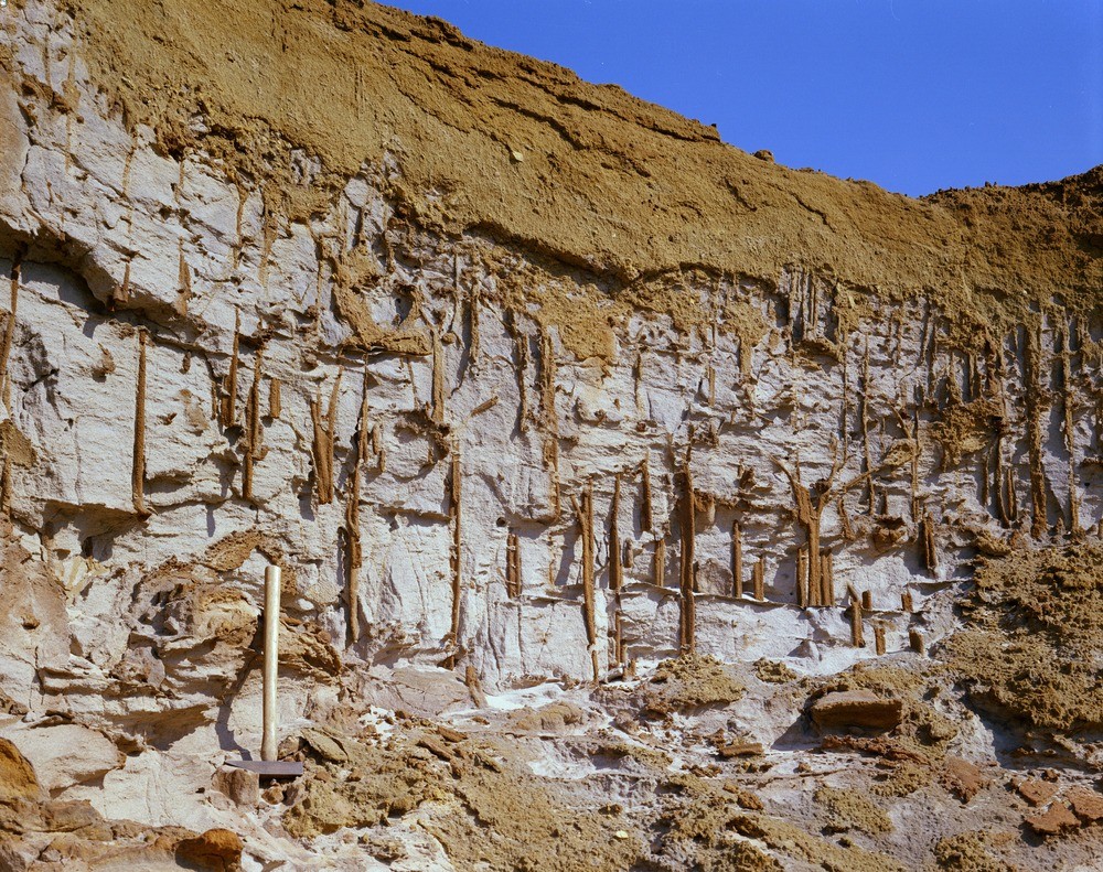
| Caption: | Blackborough Carstone Pit. Looking N. |
| Description: | Blackborough Carstone Pit. Looking N. Junction of Carstone and Leziate Beds. Loose brown pebbly sand (basal Carstone) up to 1 foot thick resting on an irregular eroded surface of white sands (Leziate Beds - topmost member of the Sandringham Sands). Vertical worm burrows infilled with coarse brown sand extend downwards into the white sands, from the erosion surface, for as much as 3 feet. Wind erosion has removed some of the white sands leaving the better-cemented sand infill at the worm burrows. |
| Date taken: | Fri Jan 01 00:00:00 GMT 1971 |
| Photographer: | Pulsford, J.M. |
| Copyright statement: | NERC |
| X longitude/easting: | 567500 |
| Y latitude/northing: | 314500 |
| Coordinate reference system, ESPG code: | 27700 (OSGB 1936 / British National Grid) |
| Orientation: | Landscape |
| Size: | 416.55 KB; 1000 x 791 pixels; 85 x 67 mm (print at 300 DPI); 265 x 209 mm (screen at 96 DPI); |
| Average Rating: | Not yet rated |
| Categories: | Unsorted Images, Geoscience subjects/ Sedimentary features/ Borings and burrows |
Loading...
Loading...
Reviews
There is currently no feedback