| P number: | P211197 |
|---|---|
| Old photograph number: | A11554 |
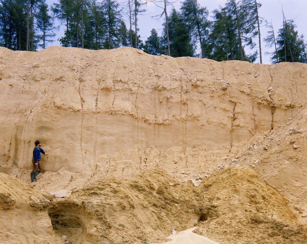
| Caption: | Babcombe Copse, 3 km. N. of Kingsteignton. |
| Description: | Babcombe Copse, 3 km. N. of Kingsteignton. Upper Greensand in Babcombe Copse Sandpit. Southern part of the northern bay of Babcombe Copse Sandpit, showing lines of tabular cherts occurring in the upper part of the Upper Greensand sequence. |
| Date taken: | Thu Jan 01 00:00:00 GMT 1970 |
| Photographer: | Jeffery, C.J. |
| Copyright statement: | NERC |
| X longitude/easting: | 286500 |
| Y latitude/northing: | 76500 |
| Coordinate reference system, ESPG code: | 27700 (OSGB 1936 / British National Grid) |
| Orientation: | Landscape |
| Size: | 354.94 KB; 1000 x 797 pixels; 85 x 67 mm (print at 300 DPI); 265 x 211 mm (screen at 96 DPI); |
| Average Rating: | Not yet rated |
| Categories: | Unsorted Images, Geoscience subjects/ Rocks, sedimentary/ Chert |
Loading...
Loading...
Reviews
There is currently no feedback