| P number: | P211115 |
|---|---|
| Old photograph number: | A11472 |
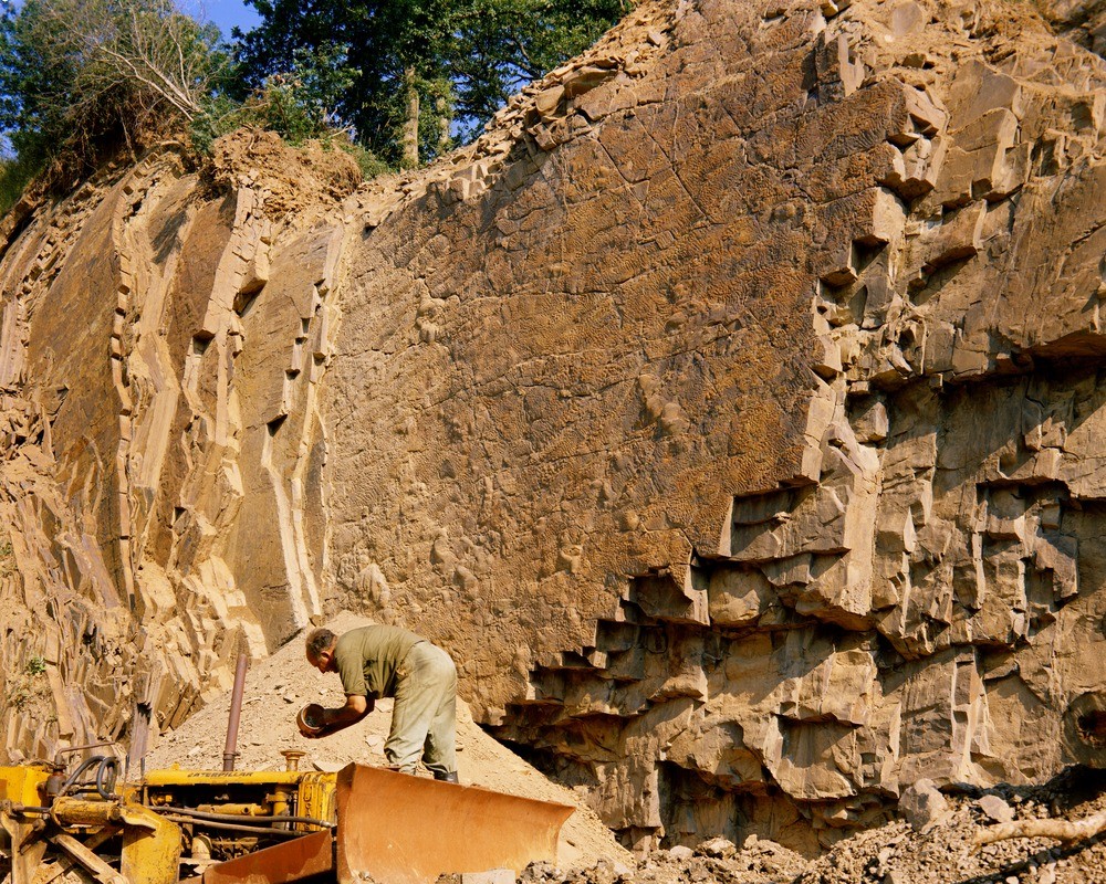
| Caption: | Quarry 320 m. E. 40 degrees N. of Newbridge, Huish. Looking SE. |
| Description: | Quarry 320 m. E. 40 degrees N. of Newbridge, Huish. Looking SE. Bottom structures in the Bude Formation. Steep overturned flaggy sandstones and siltstones of the Bude Formation. Flute marks and squamiform loadcasts occur on the base of the facing sandstone. Current direction was from N. 30 E. |
| Date taken: | Wed Jan 01 00:00:00 GMT 1969 |
| Photographer: | Pulsford, J.M. |
| Copyright statement: | NERC |
| X longitude/easting: | 254500 |
| Y latitude/northing: | 111500 |
| Coordinate reference system, ESPG code: | 27700 (OSGB 1936 / British National Grid) |
| Orientation: | Landscape |
| Size: | 435.57 KB; 1000 x 800 pixels; 85 x 68 mm (print at 300 DPI); 265 x 212 mm (screen at 96 DPI); |
| Average Rating: | Not yet rated |
| Categories: | Unsorted Images, Geoscience subjects/ Sedimentary features/ Sedimentary structures |
Loading...
Loading...
Reviews
There is currently no feedback