| P number: | P211101 |
|---|---|
| Old photograph number: | A11458 |
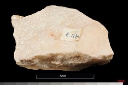
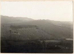
| Caption: | Ratsborough gravel-pit, Southminster. Looking W. |
| Description: | Ratsborough gravel-pit, Southminster. Looking W. Brickearth overlying terraced sand and gravel. Spreads of clayey silt, up to 8 ft. thick, cap 3rd terrace sand and gravel in this vicinity. The river which laid down these deposits is believed most probably to have been the Thames. |
| Date taken: | Fri Jan 01 00:00:00 GMT 1971 |
| Photographer: | Curtis, S. |
| Copyright statement: | NERC |
| X longitude/easting: | 595500 |
| Y latitude/northing: | 198500 |
| Coordinate reference system, ESPG code: | 27700 (OSGB 1936 / British National Grid) |
| Orientation: | Landscape |
| Size: | 334.48 KB; 1000 x 801 pixels; 85 x 68 mm (print at 300 DPI); 265 x 212 mm (screen at 96 DPI); |
| Average Rating: | Not yet rated |
| Categories: | Unsorted Images |
Loading...
Loading...
Reviews
There is currently no feedback