| P number: | P000660 |
|---|---|
| Old photograph number: | D01724 |
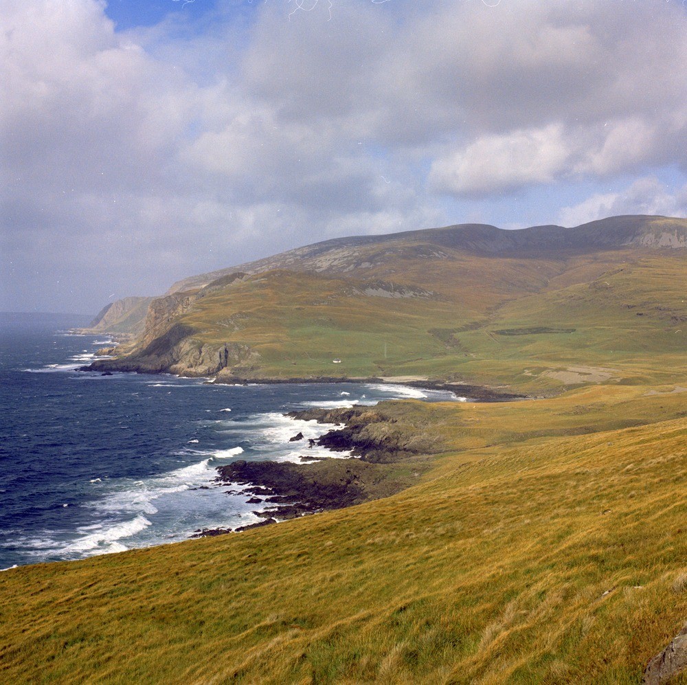
| Caption: | Isle of Rum. Glacial features at Harris. Inverness-shire. |
| Description: | To the right a late-glacial storm beach overlies a 'preglacial' rock platform and cliff in the left background. The Duian River is incised into decomposed layered ultrabasic rocks of the Western Layered Intrusion. The heavy mineral sands are chromite and magnesium-bearing olivine. It is estimated that there are 10,000 tonnes of chromite and 1 million tonnes of olivine in the top one metre of the offshore submarine delta. The area is part of the Rum Central Complex, it represents the roots of a Palaeocene central volcano. Offshore at this point is a deltaic deposit of heavy mineral sands derived from the glacial and fluvial erosion of rocks from the Complex. |
| Date taken: | Tue Jan 01 00:00:00 GMT 1974 |
| Photographer: | Pulsford, J.M. |
| Copyright statement: | NERC |
| Acknowledgment: | This image was digitized with grant-in-aid from SCRAN the Scottish Cultural Resources Access Network |
| X longitude/easting: | 134400 |
| Y latitude/northing: | 794600 |
| Coordinate reference system, ESPG code: | 27700 (OSGB 1936 / British National Grid) |
| Orientation: | Landscape |
| Size: | 333.96 KB; 1000 x 997 pixels; 85 x 84 mm (print at 300 DPI); 265 x 264 mm (screen at 96 DPI); |
| Average Rating: | Not yet rated |
| Categories: | Unsorted Images |
Loading...
Loading...
Reviews
There is currently no feedback