| P number: | P000648 |
|---|---|
| Old photograph number: | D01701 |
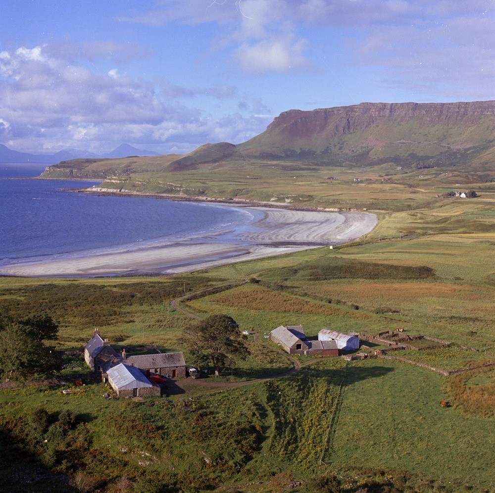
| Caption: | Isle of Eigg. Inverness-shire. Bay of Laig and Camas Sgiotaig beyond, with rocks of the Great Estuarine Series (Jurassic) below the scarp of the lava plateau of North Eigg. Moraines and landslip deposits lie at the base of the scarp. |
| Description: | Isle of Eigg. Inverness-shire. Bay of Laig and Camas Sgiotaig beyond, with rocks of the Great Estuarine Series (Jurassic) below the scarp of the lava plateau of North Eigg. Moraines and landslip deposits lie at the base of the scarp. Palaeogene (Tertiary lavas) of the Eigg Lava Formation form a scarp below which there has been considerable landslipping. It is though that the landslips took place because the stability of the plateau had been disturbed by ice action during the main Late Devensian glaciation. Note the area of blown sand. |
| Date taken: | Tue Jan 01 00:00:00 GMT 1974 |
| Photographer: | Pulsford, J.M. |
| Copyright statement: | NERC |
| Acknowledgment: | This image was digitized with grant-in-aid from SCRAN the Scottish Cultural Resources Access Network |
| X longitude/easting: | 146600 |
| Y latitude/northing: | 787500 |
| Coordinate reference system, ESPG code: | 27700 (OSGB 1936 / British National Grid) |
| Orientation: | Landscape |
| Size: | 326.06 KB; 1000 x 996 pixels; 85 x 84 mm (print at 300 DPI); 265 x 264 mm (screen at 96 DPI); |
| Average Rating: | Not yet rated |
| Categories: | Best of BGS Images/ Landscapes |
Loading...
Loading...
Reviews
There is currently no feedback