| P number: | P210815 |
|---|---|
| Old photograph number: | A11014 |
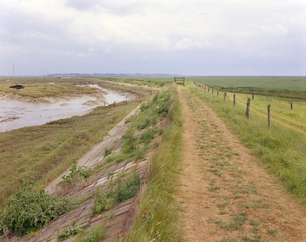
| Caption: | Tollesbury Marshes. Looking ENE. |
| Description: | Tollesbury Marshes. Looking ENE. Tollesbury Marshes. The sea wall separates the saltings (subject to twice daily inundations) from the now reclaimed marshes. Because of their daily flooding aggradation continues on the saltings and generally they are several feet higher than on the landward side of the sea wall. Mersea Island can be seen in the distance. |
| Date taken: | Mon Jan 01 00:00:00 GMT 1968 |
| Photographer: | Friend, C.A.F. |
| Copyright statement: | NERC |
| X longitude/easting: | 596500 |
| Y latitude/northing: | 210500 |
| Coordinate reference system, ESPG code: | 27700 (OSGB 1936 / British National Grid) |
| Orientation: | Landscape |
| Size: | 248.59 KB; 1000 x 791 pixels; 85 x 67 mm (print at 300 DPI); 265 x 209 mm (screen at 96 DPI); |
| Average Rating: | Not yet rated |
| Categories: | Unsorted Images, Geoscience subjects/ Landforms, marine/ Salt marsh |
Loading...
Loading...
Reviews
There is currently no feedback