| P number: | P210786 |
|---|---|
| Old photograph number: | A10950 |
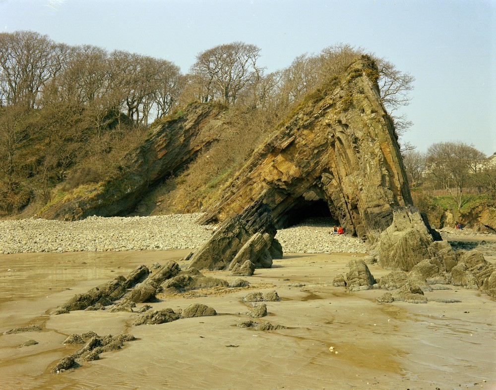
| Caption: | 370 yd. S. of Saundersfoot Harbour. Looking W. |
| Description: | 370 yd. S. of Saundersfoot Harbour. Looking W. Saundersfoot anticline. Saundersfoot anticline in the Coal Measures, showing the steeper dip in the right (northern limb). An equally sharp syncline underlies the beach to the right; measures with thin coal seams, Stammers Veins, crop out to the left. Repeat of A337. |
| Date taken: | Mon Apr 01 00:00:00 BST 1968 |
| Photographer: | Friend, C.A.F. |
| Copyright statement: | NERC |
| X longitude/easting: | 213500 |
| Y latitude/northing: | 204500 |
| Coordinate reference system, ESPG code: | 27700 (OSGB 1936 / British National Grid) |
| Orientation: | Landscape |
| Size: | 315.39 KB; 1000 x 787 pixels; 85 x 67 mm (print at 300 DPI); 265 x 208 mm (screen at 96 DPI); |
| Average Rating: | Not yet rated |
| Categories: | Best of BGS Images/ Geological structures, Geoscience subjects/ Structural features/ Folding, Geoscience subjects/ Stratigraphical/ Carboniferous |
Loading...
Loading...
Reviews
There is currently no feedback