| P number: | P000636 |
|---|---|
| Old photograph number: | D01682 |
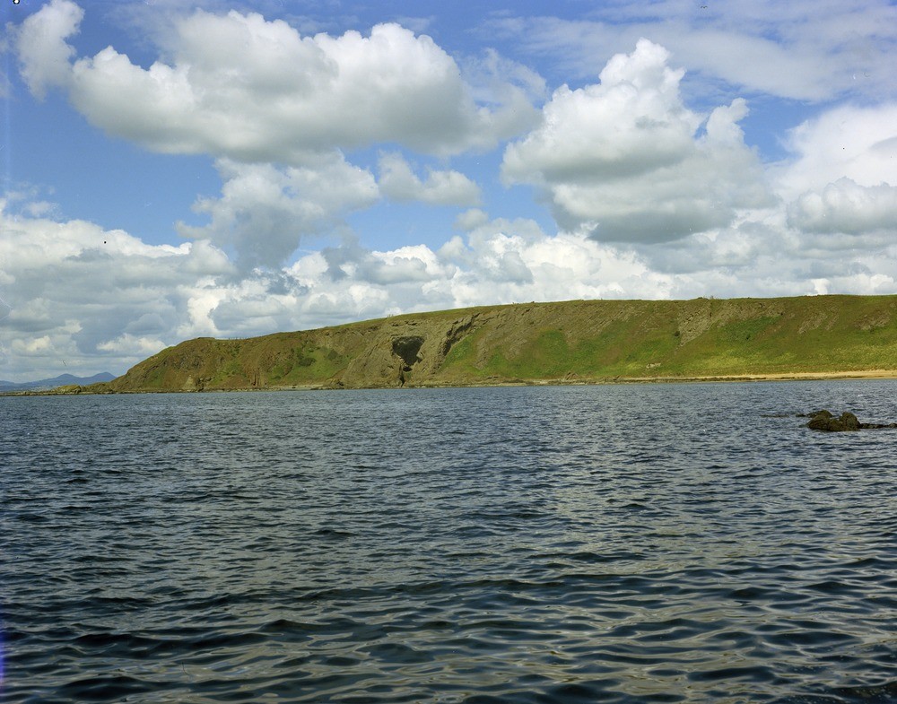
| Caption: | Kincraig neck, 2 km. west of Elie, Fifeshire. It is the largest of the coastal volcanic centres, 1.5 km. from west to east. It is composed of bedded tuffs and agglomerates. |
| Description: | Kincraig neck, 2 km. west of Elie, Fifeshire. It is the largest of the coastal volcanic centres, 1.5 km. from west to east. It is composed of bedded tuffs and agglomerates. The bedded tuffs and agglomerates in the right-hand of the picture dip to the left towards the centre of the neck; further left they are invaded by basaltic intrusions. The agglomerates are of various grades, including blocks of basalts up to 1.8 metres across. More than one hundred volcanic necks have been located in east Fife. They are approximately vertical pipe-like bodies ranging in diameter from less than 100 metres to 1.5 km. Consisting mainly of pyroclastic rocks, they pierce the Carboniferous sediments and mark the sites of former subterranean channels through which volcanic eruptive material passed. |
| Date taken: | Mon Jan 01 00:00:00 GMT 1973 |
| Photographer: | Christie, A. |
| Copyright statement: | NERC |
| Acknowledgment: | This image was digitized with grant-in-aid from SCRAN the Scottish Cultural Resources Access Network |
| X longitude/easting: | 347500 |
| Y latitude/northing: | 699400 |
| Coordinate reference system, ESPG code: | 27700 (OSGB 1936 / British National Grid) |
| Orientation: | Landscape |
| Size: | 223.95 KB; 1000 x 785 pixels; 85 x 66 mm (print at 300 DPI); 265 x 208 mm (screen at 96 DPI); |
| Average Rating: | Not yet rated |
| Categories: | Unsorted Images |
Loading...
Loading...
Reviews
There is currently no feedback