| P number: | P210743 |
|---|---|
| Old photograph number: | A10907 |
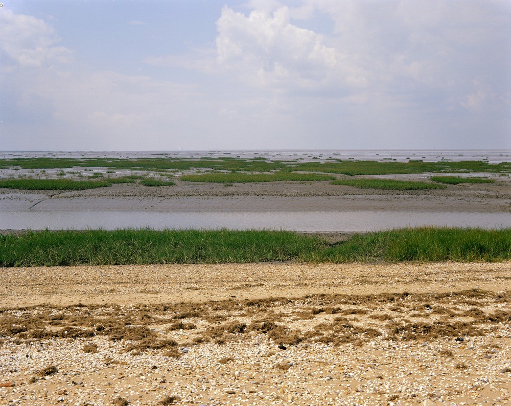
| Caption: | Salt-marsh, Snettisham Scalp, Norfolk. |
| Description: | Snettisham Scalp. Looking west-south-west. Salt-marsh and intertidal sand flat. Wolferton Creek, seen here in the foreground. Wolferton Creek carries mud from the low-lying fenland area behind the storm beach. Some of this mud is trapped by the salt-marsh vegetation, largely Salicornia, which has invaded the sand flat. In this area a succession of sea-walls has allowed the salt-marsh to move steadily outwards. Two sorts of sediment can be recognised in this part of The Wash. The first is the sand and gravel material which is carried south from the mouth of The Wash by the longshore drift, the second is the fine silt and clay supplied by the rivers and streams entering The Wash. A salt marsh is a flat and poorly drained area that is subject to periodic inundation by salt or brackish water. |
| Date taken: | Sat Jan 01 00:00:00 GMT 1966 |
| Photographer: | Pulsford, J.M. |
| Copyright statement: | NERC |
| X longitude/easting: | 564500 |
| Y latitude/northing: | 333500 |
| Coordinate reference system, ESPG code: | 27700 (OSGB 1936 / British National Grid) |
| Orientation: | Landscape |
| Size: | 298.15 KB; 1000 x 794 pixels; 85 x 67 mm (print at 300 DPI); 265 x 210 mm (screen at 96 DPI); |
| Average Rating: | Not yet rated |
| Categories: | Unsorted Images, Geoscience subjects/ Landforms, marine/ Salt marsh |
Loading...
Loading...
Reviews
There is currently no feedback