| P number: | P210742 |
|---|---|
| Old photograph number: | A10906 |
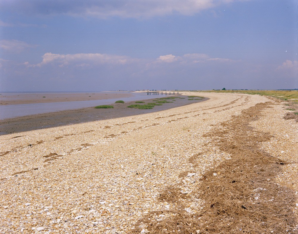
| Caption: | Shingle storm beach and intertidal sand flat at Snettisham Scalp, Norfolk. |
| Description: | Looking north at Snettisham Scalp at the shingle storm beach and intertidal sand flat. On this, the outer face of the storm beach, the gravel is rather coarser and contains a higher proportion of chalk than on the crest of the ridge. Successive high tide marks are indicated by the strand lines of weed. On the left of the picture Wolferton Creek separates the intertidal sand flat from a narrow belt of clay and silt accumulation which is being colonised by salt marsh vegetation. The sand-flat material, as with the gravel, is carried south from the Hunstanton area by the longshore drift. The formation of salt marshes has been intensively studied in the area. Under the protective belt of shingle bars and dunes, tracts of sand formed a suitable surface on which silt, brought in by the high tides was deposited as a muddy film. Colonization of the sand and mud by plants germinated by seed distribution by various agencies was next. With the growth of plants the speed of sedimentation increased because the plants checked the flow of water. As the plants spread the marsh grows higher assisted by the spread of blown sand. A system of channels forms with the growth of the marsh. |
| Date taken: | Sat Jan 01 00:00:00 GMT 1966 |
| Photographer: | Pulsford, J.M. |
| Copyright statement: | NERC |
| X longitude/easting: | 564500 |
| Y latitude/northing: | 333500 |
| Coordinate reference system, ESPG code: | 27700 (OSGB 1936 / British National Grid) |
| Orientation: | Landscape |
| Size: | 306.52 KB; 1000 x 786 pixels; 85 x 67 mm (print at 300 DPI); 265 x 208 mm (screen at 96 DPI); |
| Average Rating: | Not yet rated |
| Categories: | Unsorted Images, Geoscience subjects/ Landforms, marine/ Coastal deposition, sand-bars, shingle-ridges, storm-beaches |
Loading...
Loading...
Reviews
There is currently no feedback