| P number: | P210717 |
|---|---|
| Old photograph number: | A10881 |
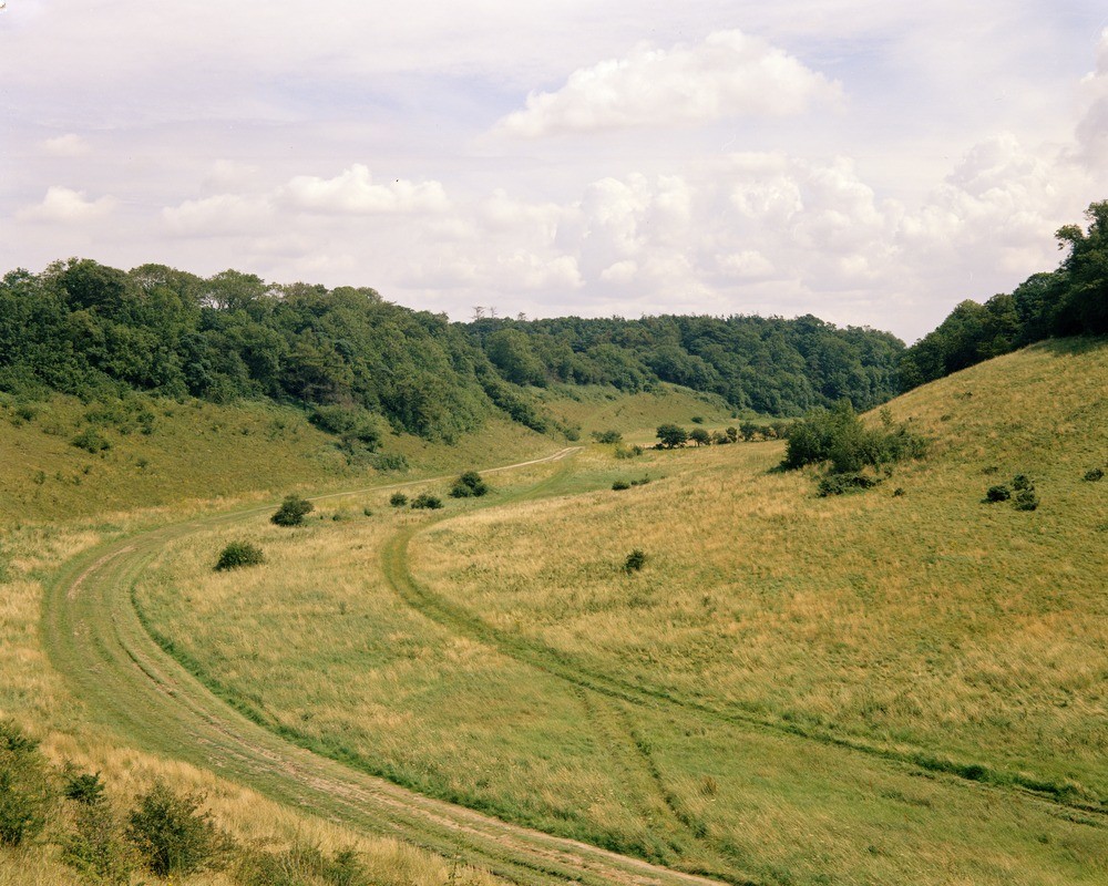
| Caption: | Dry valley at Ringstead Downs, near Hunstanton, Norfolk. |
| Description: | Looking east at Ringstead Downs, near Hunstanton. Ringstead Downs, a dry valley in the Chalk. This steep-sided feature runs from Barrett Ringstead Farm to Ringstead Village. East of the village the valley opens out into a series of dry valleys which stretch back as far as Brancaster and Docking. Springs emerging from the Lower Chalk at Barrett Ringstead Farm supply a small brook which occupies the lower part of the valley. The dry part of the valley is cut wholly in Chalk but in places, e.g. the right-hand wall in the picture, later deposits of drift have modified its shape. Cambering has reduced the original gorge-like form to the smooth slopes seen here. The Chalk is a Cretaceous very fine-grained limestone composed of up to 90 percent of minute calcite crystals derived from the disintegration of coccoliths and other nannofossils. |
| Date taken: | Sat Jan 01 00:00:00 GMT 1966 |
| Photographer: | Pulsford, J.M. |
| Copyright statement: | NERC |
| X longitude/easting: | 569500 |
| Y latitude/northing: | 339500 |
| Coordinate reference system, ESPG code: | 27700 (OSGB 1936 / British National Grid) |
| Orientation: | Landscape |
| Size: | 262.33 KB; 1000 x 800 pixels; 85 x 68 mm (print at 300 DPI); 265 x 212 mm (screen at 96 DPI); |
| Average Rating: | Not yet rated |
| Categories: | Unsorted Images, Geoscience subjects/ Landforms, river/ Dry valley |
Loading...
Loading...
Reviews
There is currently no feedback