| P number: | P210678 |
|---|---|
| Old photograph number: | A10842 |
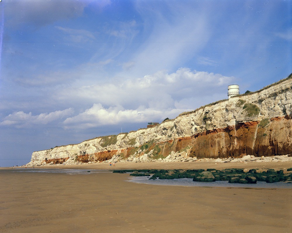
| Caption: | Northern end of Hunstanton Cliffs. Looking NE. |
| Description: | Northern end of Hunstanton Cliffs. Looking NE. The line of the cliffs turns from north-north-east to north-east northwards of the lighthouse, exposing a dip section. Both zones of the Lower Chalk are present here, the junction between them being marked by the Totternhoe Stone (visible as a bed of grey chalk at the level of the drainage pipe below the lighthouse). The reefs in the foreground are composed of Carstone. See descriptions following for further details. |
| Date taken: | Sat Jan 01 00:00:00 GMT 1966 |
| Photographer: | Pulsford, J.M. |
| Copyright statement: | NERC |
| X longitude/easting: | 564500 |
| Y latitude/northing: | 342500 |
| Coordinate reference system, ESPG code: | 27700 (OSGB 1936 / British National Grid) |
| Orientation: | Landscape |
| Size: | 211.98 KB; 1000 x 797 pixels; 85 x 67 mm (print at 300 DPI); 265 x 211 mm (screen at 96 DPI); |
| Average Rating: | Not yet rated |
| Categories: | Unsorted Images, Geoscience subjects/ Landforms, marine/ Cliffs, Geoscience subjects/ Stratigraphical/ Cretaceous |
Loading...
Loading...
Reviews
There is currently no feedback