| P number: | P210494 |
|---|---|
| Old photograph number: | A10595 |
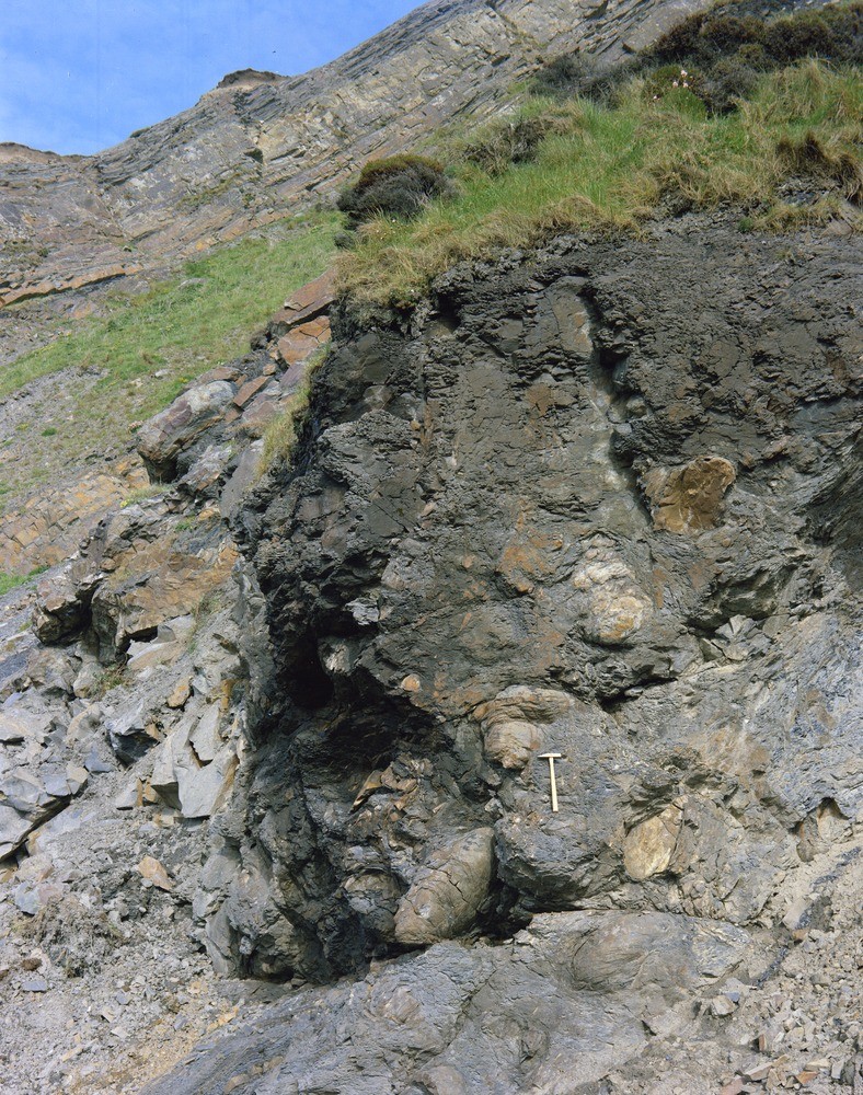
| Caption: | Cliff 200 yd. NE of Higher Longbeak, 2500 yd. S. 32 degrees W. of Bude Station. Looking E. |
| Description: | Cliff 200 yd. NE of Higher Longbeak, 2500 yd. S. 32 degrees W. of Bude Station. Looking E. Slump breccia in the Bude Formation. The 'slump breccia' consisting of large sandstone balls set in a dark shaly sandstone matrix, forms the lowest lithological marker band within the Bude Formation established south of Bude. At this locality the bed dips steeply northwards, forming the inverted limb of an overturned syncline. |
| Date taken: | Sat Jan 01 00:00:00 GMT 1966 |
| Photographer: | Friend, C.A.F. |
| Copyright statement: | NERC |
| X longitude/easting: | 219500 |
| Y latitude/northing: | 103500 |
| Coordinate reference system, ESPG code: | 27700 (OSGB 1936 / British National Grid) |
| Orientation: | Portrait |
| Size: | 415.77 KB; 788 x 1000 pixels; 67 x 85 mm (print at 300 DPI); 208 x 265 mm (screen at 96 DPI); |
| Average Rating: | Not yet rated |
| Categories: | Unsorted Images, Geoscience subjects/ Structural features/ Brecciation |
Loading...
Loading...
Reviews
There is currently no feedback